Harbour Breton geodata
Harbour Breton (Newfoundland and Labrador) is a populated place; located in Canada in America/St_Johns (GMT-2.5) time zone. With population of 1,898 people, there are 770 cities with bigger population in this country. Compared to other cities in Canada, 50.7% of cities are located further ↓South; 97.7% of cities are located further ←West and 99.7% of cities have higher elevation than Harbour Breton. Note1


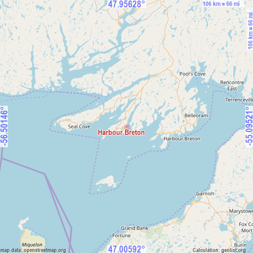
Harbour Breton GPS coordinates[2]
47° 28' 59.7" North, 55° 47' 53.988" West
| Map corner | latitude | longitude |
|---|---|---|
| Upper-left | 47.95628°, | -56.50146° |
| Center: | 47.48325°, | -55.79833° |
| Lower-right: | 47.00592°, | -55.09521° |
| Map W x H: | 105.7×105.7 km | = 65.7×65.7mi |
| max Lat: | 73.03752° ⇑49.3% North |
| Harbour Breton: | 47.48325° |
| min Lat: | ⇓50.7% South 42.05009° |
| min Long | Harbour Breton | max Long |
| -139.43328° | -55.79833° | -52.70931° |
| W 97.7%⇐ | ⇒2.3% E |
Elevation
Elevation of Harbour Breton is 1 m = 3 ft, and this is 253.4 m = 831 ft below average elevation for this country.
| Max E: |
1518 m = 4980 ft | 99.7% |
| Avg. | 254.4 m = 835 ft | |
| Harbour Breton | 1 m = 3 ft | |
Min E: |
-2 m = -7 ft | 0.3% |
See also: Canada elevation on elevation.city.
Geographical zone
Harbour Breton is located in North temperate zone (between Tropic of Cancer and the Arctic Circle). Distance of this North polar circle is 2121.5 km =1318.2 mi to North.| Distance of | km | miles | from Harbour Breton |
|---|---|---|---|
| North Pole | 4727.4 | 2937.5 | to North |
| Arctic Circle | 2121.5 | 1318.2 | to North |
| Tropic Cancer | 2673.7 | 1661.4 | to South |
| Equator | 5279.6 | 3280.6 | to South |


Nearby cities:
15 places around Harbour Breton: (largest is in red/bold)
• Bay Roberts
190.6 km =118.4 mi,  86°
86°
• Blaketown
167.8 km =104.3 mi, 90°
• Bloomfield
173.3 km =107.7 mi,  54°
54°
• Botwood
188.3 km =117 mi,  10°
10°
• Burgeo
137.1 km =85.2 mi,  276°
276°
• Carbonear
195.6 km =121.5 mi,  81°
81°
• Clarenville-Shoal Harbour
157 km =97.6 mi,  60°
60°
• Gambo
186.3 km =115.8 mi,  39°
39°
• Grand Bank
42.7 km =26.5 mi,  176°
176°
• Grand Falls-Windsor
161.5 km =100.4 mi,  3°
3°
• Green's Harbour
173.4 km =107.7 mi, 84°
• Hare Bay
201.4 km =125.1 mi, 41°
• Lewisporte
204.1 km =126.8 mi,  15°
15°
• Marystown
60.3 km =37.5 mi,  125°
125°
• Upper Island Cove
194.7 km =121 mi, 84°
Sources, notices
• [Note1] Compared only with cities in Canada existing in our database
• [Src1] Map data: © OpenStreetMap contributors (CC-BY-SA)
• [Src2] Other city data from geonames.org with taken over terms of usage.
• [Src3] Geographical zone / Annual Mean Temperature by Robert A. Rohde @ Wikipedia
