Clarenville-Shoal Harbour geodata
Clarenville-Shoal Harbour (Newfoundland and Labrador) is a populated place; located in Canada in America/St_Johns (GMT-2.5) time zone. With population of 3,478 people, there are 575 cities with bigger population in this country. Compared to other cities in Canada, 55.3% of cities are located further ↓South; 98.8% of cities are located further ←West and 99.7% of cities have higher elevation than Clarenville-Shoal Harbour. Note1
Current local time in Clarenville-Shoal Harbour:
06:31 AM, FridayDifference from your time zone: hours


Clarenville-Shoal Harbour GPS coordinates[2]
48° 10' 49.8" North, 53° 58' 11.352" West
| Map corner | latitude | longitude |
|---|---|---|
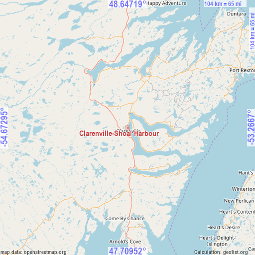
| Upper-left | 48.64719°, | -54.67295° |
| Center: | 48.1805°, | -53.96982° |
| Lower-right: | 47.70952°, | -53.2667° |
| Map W x H: | 104.3×104.3 km | = 64.8×64.8mi |
| max Lat: | 73.03752° ⇑44.7% North |
| Clarenville-Shoal Harbour: | 48.1805° |
| min Lat: | ⇓55.3% South 42.05009° |
| min Long | Clarenville-Sho | max Long |
| -139.43328° | -53.96982° | -52.70931° |
| W 98.8%⇐ | ⇒1.2% E |
Elevation
Elevation of Clarenville-Shoal Harbour is 1 m = 3 ft, and this is 253.4 m = 831 ft below average elevation for this country.
| Max E: |
1518 m = 4980 ft | 99.7% |
| Avg. | 254.4 m = 835 ft | |
| Clarenville-Shoal Harbour | 1 m = 3 ft | |
Min E: |
-2 m = -7 ft | 0.3% |
See also: Canada elevation on elevation.city.
Geographical zone
Clarenville-Shoal Harbour is located in North temperate zone (between Tropic of Cancer and the Arctic Circle). Distance of this North polar circle is 2044 km =1270.1 mi to North.| Distance of | km | miles | from Clarenville-Shoal Harbour |
|---|---|---|---|
| North Pole | 4649.9 | 2889.3 | to North |
| Arctic Circle | 2044 | 1270.1 | to North |
| Tropic Cancer | 2751.3 | 1709.6 | to South |
| Equator | 5357.2 | 3328.8 | to South |


Nearby cities:
15 places around Clarenville-Shoal Harbour: (largest is in red/bold)
• Bay Roberts
83.3 km =51.8 mi,  140°
140°
• Blaketown
83.2 km =51.7 mi,  158°
158°
• Bloomfield
23.2 km =14.4 mi,  13°
13°
• Bonavista
81.9 km =50.9 mi,  50°
50°
• Carbonear
75.1 km =46.7 mi,  131°
131°
• Catalina
75.5 km =46.9 mi,  60°
60°
• Conception Bay South
104.8 km =65.1 mi, 136°
• Gambo
69.4 km =43.1 mi,  344°
344°
• Green's Harbour
70.3 km =43.7 mi,  149°
149°
• Hare Bay
74.5 km =46.3 mi,  357°
357°
• Mount Pearl
115.4 km =71.7 mi, 129°
• St. John's
116.3 km =72.3 mi, 126°
• Torbay
108.5 km =67.4 mi,  121°
121°
• Upper Island Cove
81.5 km =50.6 mi, 136°
• Wabana
97.5 km =60.6 mi, 128°
Sources, notices
• [Note1] Compared only with cities in Canada existing in our database
• [Src1] Map data: © OpenStreetMap contributors (CC-BY-SA)
• [Src2] Other city data from geonames.org with taken over terms of usage.
• [Src3] Geographical zone / Annual Mean Temperature by Robert A. Rohde @ Wikipedia
