Blaketown geodata
Blaketown (Newfoundland and Labrador) is a populated place; located in Canada in America/St_Johns (GMT-2.5) time zone. With population of 605 people, there are 1147 cities with bigger population in this country. Compared to other cities in Canada, 50.6% of cities are located further ↓South; 99% of cities are located further ←West and 60.2% of cities have higher elevation than Blaketown. Note1


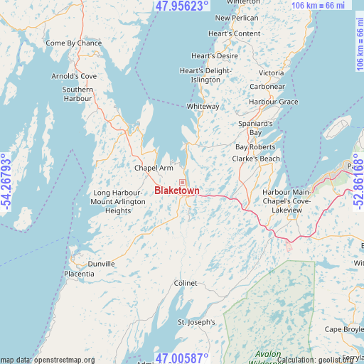
Blaketown GPS coordinates[2]
47° 28' 59.52" North, 53° 33' 53.28" West
| Map corner | latitude | longitude |
|---|---|---|
| Upper-left | 47.95623°, | -54.26793° |
| Center: | 47.4832°, | -53.5648° |
| Lower-right: | 47.00587°, | -52.86168° |
| Map W x H: | 105.7×105.7 km | = 65.7×65.7mi |
| max Lat: | 73.03752° ⇑49.4% North |
| Blaketown: | 47.4832° |
| min Lat: | ⇓50.6% South 42.05009° |
| min Long | Blaketown | max Long |
| -139.43328° | -53.5648° | -52.70931° |
| W 99%⇐ | ⇒1% E |
Elevation
Elevation of Blaketown is 97 m = 318 ft, and this is 157.4 m = 516 ft below average elevation for this country.
| Max E: |
1518 m = 4980 ft | 60.2% |
| Avg. | 254.4 m = 835 ft | |
| Blaketown | 97 m = 318 ft | |
Min E: |
-2 m = -7 ft | 39.8% |
See also: Canada elevation on elevation.city.
Geographical zone
Blaketown is located in North temperate zone (between Tropic of Cancer and the Arctic Circle). Distance of this North polar circle is 2121.5 km =1318.2 mi to North.| Distance of | km | miles | from Blaketown |
|---|---|---|---|
| North Pole | 4727.4 | 2937.5 | to North |
| Arctic Circle | 2121.5 | 1318.2 | to North |
| Tropic Cancer | 2673.7 | 1661.4 | to South |
| Equator | 5279.6 | 3280.6 | to South |


Nearby cities:
15 places around Blaketown: (largest is in red/bold)
• Bay Roberts
26 km =16.2 mi,  60°
60°
• Bloomfield
103.1 km =64.1 mi,  346°
346°
• Bonavista
134 km =83.3 mi,  14°
14°
• Carbonear
38.2 km =23.7 mi,  43°
43°
• Catalina
120.4 km =74.8 mi,  17°
17°
• Clarenville-Shoal Harbour
83.2 km =51.7 mi,  338°
338°
• Conception Bay South
42.6 km =26.5 mi,  87°
87°
• Goulds
59.4 km =36.9 mi, 92°
• Green's Harbour
17.4 km =10.8 mi, 16°
• Marystown
124.4 km =77.3 mi,  253°
253°
• Mount Pearl
59 km =36.7 mi, 86°
• St. John's
64.9 km =40.3 mi,  81°
81°
• Torbay
65.8 km =40.9 mi,  71°
71°
• Upper Island Cove
32.1 km =19.9 mi,  54°
54°
• Wabana
49.2 km =30.6 mi, 70°
Sources, notices
• [Note1] Compared only with cities in Canada existing in our database
• [Src1] Map data: © OpenStreetMap contributors (CC-BY-SA)
• [Src2] Other city data from geonames.org with taken over terms of usage.
• [Src3] Geographical zone / Annual Mean Temperature by Robert A. Rohde @ Wikipedia
