Grand Forks geodata
Grand Forks (British Columbia) is a populated place; located in Canada in America/Vancouver (GMT-7) time zone. With population of 4,208 people, there are 517 cities with bigger population in this country. Compared to other cities in Canada, 62.3% of cities are located further ↓South; 86.4% of cities are located further →East and 82.5% of cities have lower elevation than Grand Forks. Note1
Administrative division(s):
- Level 1: British Columbia
- Level 2: Regional District of Kootenay-Boundary
- Level 3: Grand Forks


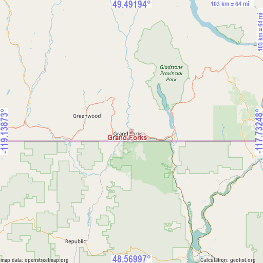
Grand Forks GPS coordinates[2]
49° 1' 59.124" North, 118° 26' 8.16" West
| Map corner | latitude | longitude |
|---|---|---|
| Upper-left | 49.49194°, | -119.13873° |
| Center: | 49.03309°, | -118.4356° |
| Lower-right: | 48.56997°, | -117.73248° |
| Map W x H: | 102.5×102.5 km | = 63.7×63.7mi |
| max Lat: | 73.03752° ⇑37.7% North |
| Grand Forks: | 49.03309° |
| min Lat: | ⇓62.3% South 42.05009° |
| min Long | Grand Forks | max Long |
| -139.43328° | -118.4356° | -52.70931° |
| W 13.6%⇐ | ⇒86.4% E |
Elevation
Elevation of Grand Forks is 514 m = 1686 ft, and this is 259.6 m = 852 ft above average elevation for this country.
| Max E: |
1518 m = 4980 ft | 17.5% |
| Grand Forks | 514 m 1686 ft | |
| Avg. | 254.4 m = 835 ft | |
Min E: |
-2 m = -7 ft | 82.5% |
See also: Canada elevation on elevation.city.
Geographical zone
Grand Forks is located in North temperate zone (between Tropic of Cancer and the Arctic Circle). Distance of this North polar circle is 1949.2 km =1211.2 mi to North.| Distance of | km | miles | from Grand Forks |
|---|---|---|---|
| North Pole | 4555.1 | 2830.4 | to North |
| Arctic Circle | 1949.2 | 1211.2 | to North |
| Tropic Cancer | 2846 | 1768.4 | to South |
| Equator | 5452 | 3387.7 | to South |


Nearby cities:
15 places around Grand Forks: (largest is in red/bold)
• Castlegar
65.1 km =40.5 mi,  60°
60°
• Ellison
120.7 km =75 mi,  326°
326°
• Fruitvale
65 km =40.4 mi,  81°
81°
• Kelowna
121.2 km =75.3 mi,  321°
321°
• Nelson
98.3 km =61.1 mi, 58°
• Okanagan Falls
89.4 km =55.6 mi,  293°
293°
• Oliver
83 km =51.6 mi,  281°
281°
• Osoyoos
74.1 km =46 mi,  269°
269°
• Penticton
97.2 km =60.4 mi,  300°
300°
• Rossland
46.5 km =28.9 mi, 83°
• Salmo
86.9 km =54 mi, 77°
• Sion
4.5 km =2.8 mi,  246°
246°
• Summerland
109.4 km =68 mi,  305°
305°
• Trail
53.9 km =33.5 mi, 82°
• West Kelowna
124 km =77.1 mi, 318°
Sources, notices
• [Note1] Compared only with cities in Canada existing in our database
• [Src1] Map data: © OpenStreetMap contributors (CC-BY-SA)
• [Src2] Other city data from geonames.org with taken over terms of usage.
• [Src3] Geographical zone / Annual Mean Temperature by Robert A. Rohde @ Wikipedia
