Fruitvale geodata
Fruitvale (British Columbia) is a populated place; located in Canada in America/Vancouver (GMT-7) time zone. With population of 3,790 people, there are 550 cities with bigger population in this country. Compared to other cities in Canada, 63.8% of cities are located further ↓South; 85.4% of cities are located further →East and 89.4% of cities have lower elevation than Fruitvale. Note1
Administrative division(s):
- Level 1: British Columbia
- Level 2: Regional District of Kootenay-Boundary
- Level 3: Fruitvale


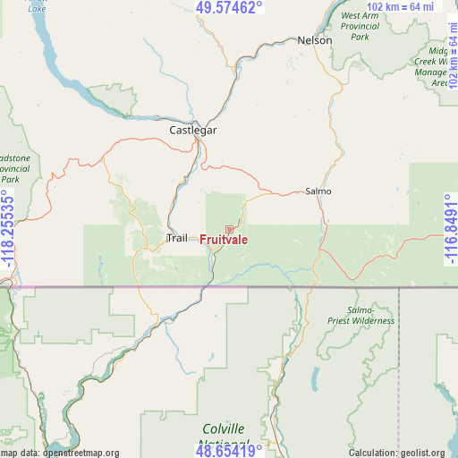
Fruitvale GPS coordinates[2]
49° 6' 59.544" North, 117° 33' 7.992" West
| Map corner | latitude | longitude |
|---|---|---|
| Upper-left | 49.57462°, | -118.25535° |
| Center: | 49.11654°, | -117.55222° |
| Lower-right: | 48.65419°, | -116.8491° |
| Map W x H: | 102.3×102.3 km | = 63.6×63.6mi |
| max Lat: | 73.03752° ⇑36.2% North |
| Fruitvale: | 49.11654° |
| min Lat: | ⇓63.8% South 42.05009° |
| min Long | Fruitvale | max Long |
| -139.43328° | -117.55222° | -52.70931° |
| W 14.6%⇐ | ⇒85.4% E |
Elevation
Elevation of Fruitvale is 659 m = 2162 ft, and this is 404.6 m = 1327 ft above average elevation for this country.
| Max E: |
1518 m = 4980 ft | 10.6% |
| Fruitvale | 659 m 2162 ft | |
| Avg. | 254.4 m = 835 ft | |
Min E: |
-2 m = -7 ft | 89.4% |
See also: Canada elevation on elevation.city.
Geographical zone
Fruitvale is located in North temperate zone (between Tropic of Cancer and the Arctic Circle). Distance of this North polar circle is 1939.9 km =1205.4 mi to North.| Distance of | km | miles | from Fruitvale |
|---|---|---|---|
| North Pole | 4545.8 | 2824.6 | to North |
| Arctic Circle | 1939.9 | 1205.4 | to North |
| Tropic Cancer | 2855.3 | 1774.2 | to South |
| Equator | 5461.2 | 3393.4 | to South |


Nearby cities:
15 places around Fruitvale: (largest is in red/bold)
• Castlegar
24.2 km =15 mi,  341°
341°
• Cranbrook
136.1 km =84.6 mi,  71°
71°
• Creston
76.5 km =47.5 mi,  91°
91°
• Grand Forks
65 km =40.4 mi,  261°
261°
• Kimberley
129.5 km =80.5 mi,  61°
61°
• Nakusp
127.3 km =79.1 mi,  351°
351°
• Nelson
46.8 km =29.1 mi,  24°
24°
• Okanagan Falls
148.5 km =92.3 mi,  280°
280°
• Oliver
145.7 km =90.5 mi,  272°
272°
• Osoyoos
138.7 km =86.2 mi, 266°
• Rossland
18.6 km =11.6 mi, 258°
• Salmo
22.6 km =14 mi, 65°
• Sion
69.4 km =43.1 mi, 260°
• Trail
11.1 km =6.9 mi, 260°
• Wynndel
73.1 km =45.4 mi,  84°
84°
Sources, notices
• [Note1] Compared only with cities in Canada existing in our database
• [Src1] Map data: © OpenStreetMap contributors (CC-BY-SA)
• [Src2] Other city data from geonames.org with taken over terms of usage.
• [Src3] Geographical zone / Annual Mean Temperature by Robert A. Rohde @ Wikipedia
