Castlegar geodata
Castlegar (British Columbia) is a populated place; located in Canada in America/Vancouver (GMT-7) time zone. With population of 8,715 people, there are 348 cities with bigger population in this country. Compared to other cities in Canada, 68.4% of cities are located further ↓South; 85.8% of cities are located further →East and 78.5% of cities have lower elevation than Castlegar. Note1
Administrative division(s):
- Level 1: British Columbia
- Level 2: Regional District of Central Kootenay
- Level 3: Castlegar


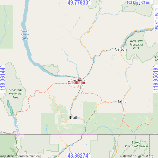
Castlegar GPS coordinates[2]
49° 19' 23.412" North, 117° 39' 29.916" West
| Map corner | latitude | longitude |
|---|---|---|
| Upper-left | 49.77933°, | -118.36144° |
| Center: | 49.32317°, | -117.65831° |
| Lower-right: | 48.86274°, | -116.95519° |
| Map W x H: | 101.9×101.9 km | = 63.3×63.3mi |
| max Lat: | 73.03752° ⇑31.6% North |
| Castlegar: | 49.32317° |
| min Lat: | ⇓68.4% South 42.05009° |
| min Long | Castlegar | max Long |
| -139.43328° | -117.65831° | -52.70931° |
| W 14.2%⇐ | ⇒85.8% E |
Elevation
Elevation of Castlegar is 414 m = 1358 ft, and this is 159.6 m = 524 ft above average elevation for this country.
| Max E: |
1518 m = 4980 ft | 21.5% |
| Castlegar | 414 m 1358 ft | |
| Avg. | 254.4 m = 835 ft | |
Min E: |
-2 m = -7 ft | 78.5% |
See also: Canada elevation on elevation.city.
Geographical zone
Castlegar is located in North temperate zone (between Tropic of Cancer and the Arctic Circle). Distance of this North polar circle is 1917 km =1191.2 mi to North.| Distance of | km | miles | from Castlegar |
|---|---|---|---|
| North Pole | 4522.8 | 2810.3 | to North |
| Arctic Circle | 1917 | 1191.2 | to North |
| Tropic Cancer | 2878.3 | 1788.5 | to South |
| Equator | 5484.2 | 3407.7 | to South |


Nearby cities:
15 places around Castlegar: (largest is in red/bold)
• Cranbrook
138.1 km =85.8 mi,  81°
81°
• Creston
87.6 km =54.4 mi,  106°
106°
• Fruitvale
24.2 km =15 mi,  161°
161°
• Grand Forks
65.1 km =40.5 mi,  240°
240°
• Kimberley
127.4 km =79.2 mi,  72°
72°
• Nakusp
103.6 km =64.4 mi,  354°
354°
• Nelson
33.4 km =20.8 mi,  53°
53°
• Okanagan Falls
138.3 km =85.9 mi,  271°
271°
• Oliver
138.3 km =85.9 mi,  263°
263°
• Osoyoos
134.3 km =83.5 mi, 256°
• Rossland
28.7 km =17.8 mi,  201°
201°
• Salmo
31.4 km =19.5 mi,  115°
115°
• Sion
69.5 km =43.2 mi, 240°
• Trail
25 km =15.5 mi,  187°
187°
• Wynndel
81.8 km =50.8 mi,  101°
101°
Sources, notices
• [Note1] Compared only with cities in Canada existing in our database
• [Src1] Map data: © OpenStreetMap contributors (CC-BY-SA)
• [Src2] Other city data from geonames.org with taken over terms of usage.
• [Src3] Geographical zone / Annual Mean Temperature by Robert A. Rohde @ Wikipedia
