Salmo geodata
Salmo (British Columbia) is a populated place; located in Canada in America/Vancouver (GMT-7) time zone. With population of 1,125 people, there are 986 cities with bigger population in this country. Compared to other cities in Canada, 65.9% of cities are located further ↓South; 84.9% of cities are located further →East and 90% of cities have lower elevation than Salmo. Note1


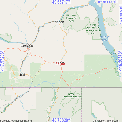
Salmo GPS coordinates[2]
49° 11' 59.496" North, 117° 16' 8.04" West
| Map corner | latitude | longitude |
|---|---|---|
| Upper-left | 49.65717°, | -117.97203° |
| Center: | 49.19986°, | -117.2689° |
| Lower-right: | 48.73829°, | -116.56578° |
| Map W x H: | 102.2×102.2 km | = 63.5×63.5mi |
| max Lat: | 73.03752° ⇑34.1% North |
| Salmo: | 49.19986° |
| min Lat: | ⇓65.9% South 42.05009° |
| min Long | Salmo | max Long |
| -139.43328° | -117.2689° | -52.70931° |
| W 15.1%⇐ | ⇒84.9% E |
Elevation
Elevation of Salmo is 665 m = 2182 ft, and this is 410.6 m = 1347 ft above average elevation for this country.
| Max E: |
1518 m = 4980 ft | 10% |
| Salmo | 665 m 2182 ft | |
| Avg. | 254.4 m = 835 ft | |
Min E: |
-2 m = -7 ft | 90% |
See also: Canada elevation on elevation.city.
Geographical zone
Salmo is located in North temperate zone (between Tropic of Cancer and the Arctic Circle). Distance of this North polar circle is 1930.7 km =1199.7 mi to North.| Distance of | km | miles | from Salmo |
|---|---|---|---|
| North Pole | 4536.6 | 2818.9 | to North |
| Arctic Circle | 1930.7 | 1199.7 | to North |
| Tropic Cancer | 2864.6 | 1780 | to South |
| Equator | 5470.5 | 3399.2 | to South |


Nearby cities:
15 places around Salmo: (largest is in red/bold)
• Castlegar
31.4 km =19.5 mi,  295°
295°
• Cranbrook
113.7 km =70.6 mi,  72°
72°
• Creston
56.9 km =35.4 mi,  101°
101°
• Fernie
162.8 km =101.2 mi,  78°
78°
• Fruitvale
22.6 km =14 mi,  245°
245°
• Grand Forks
86.9 km =54 mi,  257°
257°
• Jaffray
144.1 km =89.5 mi, 81°
• Kimberley
107 km =66.5 mi,  60°
60°
• Nakusp
122.9 km =76.4 mi,  341°
341°
• Nelson
33.4 km =20.8 mi,  357°
357°
• Osoyoos
160 km =99.4 mi, 263°
• Rossland
40.9 km =25.4 mi, 251°
• Sion
91.3 km =56.7 mi, 257°
• Trail
33.4 km =20.8 mi, 250°
• Wynndel
52.1 km =32.4 mi,  92°
92°
Sources, notices
• [Note1] Compared only with cities in Canada existing in our database
• [Src1] Map data: © OpenStreetMap contributors (CC-BY-SA)
• [Src2] Other city data from geonames.org with taken over terms of usage.
• [Src3] Geographical zone / Annual Mean Temperature by Robert A. Rohde @ Wikipedia
