Nelson geodata
Nelson (British Columbia) is a populated place; located in Canada in America/Vancouver (GMT-7) time zone. With population of 10,664 people, there are 297 cities with bigger population in this country. Compared to other cities in Canada, 70.2% of cities are located further ↓South; 85% of cities are located further →East and 83.8% of cities have lower elevation than Nelson. Note1
Administrative division(s):
- Level 1: British Columbia
- Level 2: Regional District of Central Kootenay
- Level 3: Nelson


Nelson GPS coordinates[2]
49° 29' 59.46" North, 117° 17' 7.908" West
| Map corner | latitude | longitude |
|---|---|---|
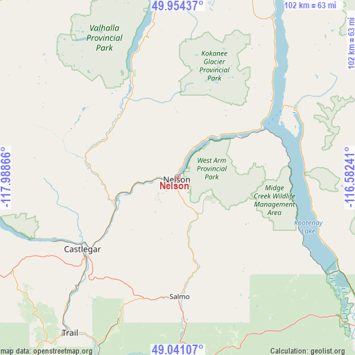
| Upper-left | 49.95437°, | -117.98866° |
| Center: | 49.49985°, | -117.28553° |
| Lower-right: | 49.04107°, | -116.58241° |
| Map W x H: | 101.5×101.5 km | = 63.1×63.1mi |
| max Lat: | 73.03752° ⇑29.8% North |
| Nelson: | 49.49985° |
| min Lat: | ⇓70.2% South 42.05009° |
| min Long | Nelson | max Long |
| -139.43328° | -117.28553° | -52.70931° |
| W 15%⇐ | ⇒85% E |
Elevation
Elevation of Nelson is 541 m = 1775 ft, and this is 286.6 m = 940 ft above average elevation for this country.
| Max E: |
1518 m = 4980 ft | 16.2% |
| Nelson | 541 m 1775 ft | |
| Avg. | 254.4 m = 835 ft | |
Min E: |
-2 m = -7 ft | 83.8% |
See also: Canada elevation on elevation.city.
Geographical zone
Nelson is located in North temperate zone (between Tropic of Cancer and the Arctic Circle). Distance of this North polar circle is 1897.3 km =1178.9 mi to North.| Distance of | km | miles | from Nelson |
|---|---|---|---|
| North Pole | 4503.2 | 2798.2 | to North |
| Arctic Circle | 1897.3 | 1178.9 | to North |
| Tropic Cancer | 2897.9 | 1800.7 | to South |
| Equator | 5503.9 | 3420 | to South |


Nearby cities:
15 places around Nelson: (largest is in red/bold)
• Castlegar
33.4 km =20.8 mi,  233°
233°
• Cranbrook
109.5 km =68 mi,  89°
89°
• Creston
72.1 km =44.8 mi,  128°
128°
• Fruitvale
46.8 km =29.1 mi,  204°
204°
• Grand Forks
98.3 km =61.1 mi,  238°
238°
• Invermere
144.1 km =89.5 mi,  38°
38°
• Jaffray
144 km =89.5 mi,  95°
95°
• Kimberley
96.2 km =59.8 mi,  78°
78°
• Lumby
146.6 km =91.1 mi,  304°
304°
• Nakusp
91.2 km =56.7 mi,  336°
336°
• Rossland
59.6 km =37 mi,  218°
218°
• Salmo
33.4 km =20.8 mi,  177°
177°
• Sion
102.7 km =63.8 mi, 238°
• Trail
53.8 km =33.4 mi,  214°
214°
• Wynndel
63.9 km =39.7 mi,  123°
123°
Sources, notices
• [Note1] Compared only with cities in Canada existing in our database
• [Src1] Map data: © OpenStreetMap contributors (CC-BY-SA)
• [Src2] Other city data from geonames.org with taken over terms of usage.
• [Src3] Geographical zone / Annual Mean Temperature by Robert A. Rohde @ Wikipedia
