Hinton geodata
Hinton (Alberta) is a populated place; located in Canada in America/Edmonton (GMT-6) time zone. With population of 9,889 people, there are 315 cities with bigger population in this country. Compared to other cities in Canada, 90.8% of cities are located further ↓South; 85.5% of cities are located further →East and 97.6% of cities have lower elevation than Hinton. Note1


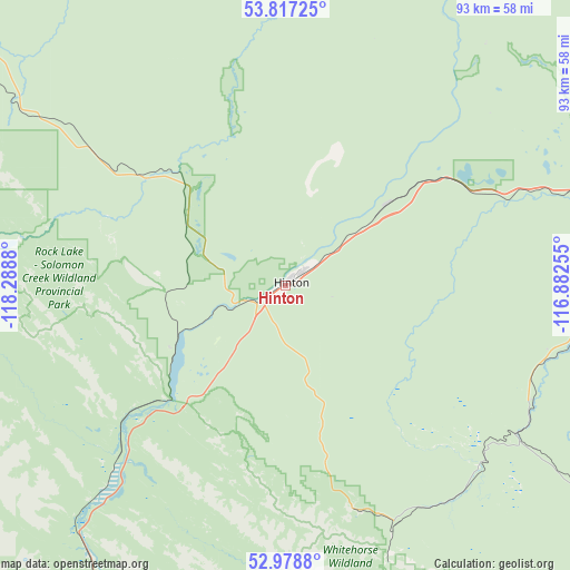
Hinton GPS coordinates[2]
53° 24' 0.324" North, 117° 35' 8.412" West
| Map corner | latitude | longitude |
|---|---|---|
| Upper-left | 53.81725°, | -118.2888° |
| Center: | 53.40009°, | -117.58567° |
| Lower-right: | 52.9788°, | -116.88255° |
| Map W x H: | 93.2×93.2 km | = 57.9×57.9mi |
| max Lat: | 73.03752° ⇑9.2% North |
| Hinton: | 53.40009° |
| min Lat: | ⇓90.8% South 42.05009° |
| min Long | Hinton | max Long |
| -139.43328° | -117.58567° | -52.70931° |
| W 14.5%⇐ | ⇒85.5% E |
Elevation
Elevation of Hinton is 1022 m = 3353 ft, and this is 767.6 m = 2518 ft above average elevation for this country.
| Max E: |
1518 m = 4980 ft | 2.4% |
| Hinton | 1022 m 3353 ft | |
| Avg. | 254.4 m = 835 ft | |
Min E: |
-2 m = -7 ft | 97.6% |
See also: Canada elevation on elevation.city.
Geographical zone
Hinton is located in North temperate zone (between Tropic of Cancer and the Arctic Circle). Distance of this North polar circle is 1463.6 km =909.4 mi to North.| Distance of | km | miles | from Hinton |
|---|---|---|---|
| North Pole | 4069.5 | 2528.7 | to North |
| Arctic Circle | 1463.6 | 909.4 | to North |
| Tropic Cancer | 3331.6 | 2070.2 | to South |
| Equator | 5937.5 | 3689.4 | to South |


Nearby cities:
15 places around Hinton: (largest is in red/bold)
• Drayton Valley
173.9 km =108.1 mi,  96°
96°
• Edson
78.8 km =49 mi,  74°
74°
• Fox Creek
122.5 km =76.1 mi,  24°
24°
• Grande Cache
115.4 km =71.7 mi,  297°
297°
• Grande Prairie
211.7 km =131.5 mi,  338°
338°
• Jasper
66.6 km =41.4 mi,  209°
209°
• Jasper Park Lodge
65.2 km =40.5 mi, 208°
• Mayerthorpe
172.6 km =107.2 mi, 69°
• Rocky Mountain House
212.6 km =132.1 mi,  122°
122°
• Swan Hills
204.3 km =126.9 mi,  44°
44°
• Valleyview
186.3 km =115.8 mi,  6°
6°
• Wedgewood
206.4 km =128.3 mi, 338°
• Wembley
219 km =136.1 mi,  332°
332°
• Westlake
217.5 km =135.1 mi, 338°
• Whitecourt
150.1 km =93.3 mi,  56°
56°
Sources, notices
• [Note1] Compared only with cities in Canada existing in our database
• [Src1] Map data: © OpenStreetMap contributors (CC-BY-SA)
• [Src2] Other city data from geonames.org with taken over terms of usage.
• [Src3] Geographical zone / Annual Mean Temperature by Robert A. Rohde @ Wikipedia
