Fox Creek geodata
Fox Creek (Alberta) is a populated place; located in Canada in America/Edmonton (GMT-6) time zone. With population of 2,457 people, there are 681 cities with bigger population in this country. Compared to other cities in Canada, 94.2% of cities are located further ↓South; 84.6% of cities are located further →East and 95.1% of cities have lower elevation than Fox Creek. Note1


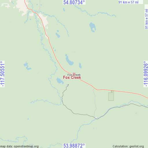
Fox Creek GPS coordinates[2]
54° 24' 0.252" North, 116° 48' 8.568" West
| Map corner | latitude | longitude |
|---|---|---|
| Upper-left | 54.80734°, | -117.50551° |
| Center: | 54.40007°, | -116.80238° |
| Lower-right: | 53.98872°, | -116.09926° |
| Map W x H: | 91×91 km | = 56.5×56.5mi |
| max Lat: | 73.03752° ⇑5.8% North |
| Fox Creek: | 54.40007° |
| min Lat: | ⇓94.2% South 42.05009° |
| min Long | Fox Creek | max Long |
| -139.43328° | -116.80238° | -52.70931° |
| W 15.4%⇐ | ⇒84.6% E |
Elevation
Elevation of Fox Creek is 832 m = 2730 ft, and this is 577.6 m = 1895 ft above average elevation for this country.
| Max E: |
1518 m = 4980 ft | 4.9% |
| Fox Creek | 832 m 2730 ft | |
| Avg. | 254.4 m = 835 ft | |
Min E: |
-2 m = -7 ft | 95.1% |
See also: Canada elevation on elevation.city.
Geographical zone
Fox Creek is located in North temperate zone (between Tropic of Cancer and the Arctic Circle). Distance of this North polar circle is 1352.5 km =840.4 mi to North.| Distance of | km | miles | from Fox Creek |
|---|---|---|---|
| North Pole | 3958.3 | 2459.6 | to North |
| Arctic Circle | 1352.5 | 840.4 | to North |
| Tropic Cancer | 3442.8 | 2139.3 | to South |
| Equator | 6048.7 | 3758.5 | to South |


Nearby cities:
15 places around Fox Creek: (largest is in red/bold)
• Barrhead
158.7 km =98.6 mi,  100°
100°
• Edson
93.9 km =58.3 mi,  165°
165°
• Falher
150.4 km =93.5 mi,  350°
350°
• Grande Cache
162.5 km =101 mi,  249°
249°
• Grande Prairie
154 km =95.7 mi,  303°
303°
• High Prairie
116.7 km =72.5 mi,  9°
9°
• Hinton
122.5 km =76.1 mi,  204°
204°
• Mayerthorpe
119.5 km =74.3 mi,  114°
114°
• Sexsmith
165.1 km =102.6 mi,  309°
309°
• Slave Lake
163.1 km =101.3 mi,  52°
52°
• Swan Hills
96.9 km =60.2 mi,  68°
68°
• Valleyview
80.4 km =50 mi,  337°
337°
• Wedgewood
149.8 km =93.1 mi, 302°
• Westlake
157.5 km =97.9 mi, 305°
• Whitecourt
77.7 km =48.3 mi, 110°
Sources, notices
• [Note1] Compared only with cities in Canada existing in our database
• [Src1] Map data: © OpenStreetMap contributors (CC-BY-SA)
• [Src2] Other city data from geonames.org with taken over terms of usage.
• [Src3] Geographical zone / Annual Mean Temperature by Robert A. Rohde @ Wikipedia
