Kimberley geodata
Kimberley (British Columbia) is a populated place; located in Canada in America/Edmonton (GMT-6) time zone. With population of 6,513 people, there are 416 cities with bigger population in this country. Compared to other cities in Canada, 72.1% of cities are located further ↓South; 84% of cities are located further →East and 98.6% of cities have lower elevation than Kimberley. Note1
Administrative division(s):
- Level 1: British Columbia
- Level 2: Regional District of East Kootenay
- Level 3: Kimberley


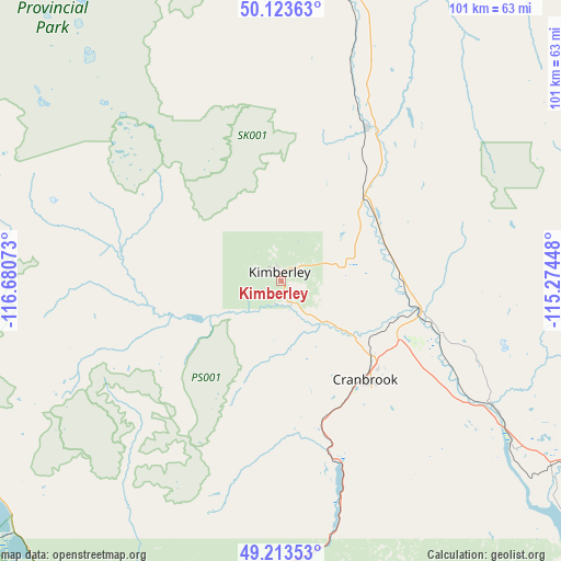
Kimberley GPS coordinates[2]
49° 40' 14.556" North, 115° 58' 39.36" West
| Map corner | latitude | longitude |
|---|---|---|
| Upper-left | 50.12363°, | -116.68073° |
| Center: | 49.67071°, | -115.9776° |
| Lower-right: | 49.21353°, | -115.27448° |
| Map W x H: | 101.2×101.2 km | = 62.9×62.9mi |
| max Lat: | 73.03752° ⇑27.9% North |
| Kimberley: | 49.67071° |
| min Lat: | ⇓72.1% South 42.05009° |
| min Long | Kimberley | max Long |
| -139.43328° | -115.9776° | -52.70931° |
| W 16%⇐ | ⇒84% E |
Elevation
Elevation of Kimberley is 1067 m = 3501 ft, and this is 812.6 m = 2666 ft above average elevation for this country.
| Max E: |
1518 m = 4980 ft | 1.4% |
| Kimberley | 1067 m 3501 ft | |
| Avg. | 254.4 m = 835 ft | |
Min E: |
-2 m = -7 ft | 98.6% |
See also: Canada elevation on elevation.city.
Geographical zone
Kimberley is located in North temperate zone (between Tropic of Cancer and the Arctic Circle). Distance of this North polar circle is 1878.3 km =1167.1 mi to North.| Distance of | km | miles | from Kimberley |
|---|---|---|---|
| North Pole | 4484.2 | 2786.4 | to North |
| Arctic Circle | 1878.3 | 1167.1 | to North |
| Tropic Cancer | 2916.9 | 1812.5 | to South |
| Equator | 5522.9 | 3431.8 | to South |


Nearby cities:
15 places around Kimberley: (largest is in red/bold)
• Castlegar
127.4 km =79.2 mi,  252°
252°
• Cranbrook
24.2 km =15 mi,  141°
141°
• Creston
74 km =46 mi,  210°
210°
• Elkford
88.9 km =55.2 mi,  61°
61°
• Fernie
68.2 km =42.4 mi,  106°
106°
• Fruitvale
129.5 km =80.5 mi,  241°
241°
• Invermere
94.2 km =58.5 mi,  357°
357°
• Jaffray
58.3 km =36.2 mi,  123°
123°
• Nakusp
145.5 km =90.4 mi,  296°
296°
• Nelson
96.2 km =59.8 mi,  258°
258°
• Rossland
147.4 km =91.6 mi, 243°
• Salmo
107 km =66.5 mi, 240°
• Sparwood
78.9 km =49 mi,  84°
84°
• Trail
140 km =87 mi, 243°
• Wynndel
68.6 km =42.6 mi,  217°
217°
Sources, notices
• [Note1] Compared only with cities in Canada existing in our database
• [Src1] Map data: © OpenStreetMap contributors (CC-BY-SA)
• [Src2] Other city data from geonames.org with taken over terms of usage.
• [Src3] Geographical zone / Annual Mean Temperature by Robert A. Rohde @ Wikipedia
