Melville geodata
Melville (Saskatchewan) is a populated place; located in Canada in America/Regina (GMT-6) time zone. With population of 4,127 people, there are 524 cities with bigger population in this country. Compared to other cities in Canada, 81.9% of cities are located further ↓South; 70.5% of cities are located further →East and 84.1% of cities have lower elevation than Melville. Note1


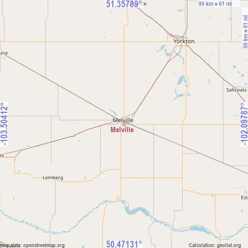
Melville GPS coordinates[2]
50° 55' 0.156" North, 102° 48' 3.564" West
| Map corner | latitude | longitude |
|---|---|---|
| Upper-left | 51.35789°, | -103.50412° |
| Center: | 50.91671°, | -102.80099° |
| Lower-right: | 50.47131°, | -102.09787° |
| Map W x H: | 98.6×98.6 km | = 61.3×61.3mi |
| max Lat: | 73.03752° ⇑18.1% North |
| Melville: | 50.91671° |
| min Lat: | ⇓81.9% South 42.05009° |
| min Long | Melville | max Long |
| -139.43328° | -102.80099° | -52.70931° |
| W 29.5%⇐ | ⇒70.5% E |
Elevation
Elevation of Melville is 549 m = 1801 ft, and this is 294.6 m = 967 ft above average elevation for this country.
| Max E: |
1518 m = 4980 ft | 15.9% |
| Melville | 549 m 1801 ft | |
| Avg. | 254.4 m = 835 ft | |
Min E: |
-2 m = -7 ft | 84.1% |
See also: Canada elevation on elevation.city.
Geographical zone
Melville is located in North temperate zone (between Tropic of Cancer and the Arctic Circle). Distance of this North polar circle is 1739.8 km =1081.1 mi to North.| Distance of | km | miles | from Melville |
|---|---|---|---|
| North Pole | 4345.7 | 2700.3 | to North |
| Arctic Circle | 1739.8 | 1081.1 | to North |
| Tropic Cancer | 3055.5 | 1898.6 | to South |
| Equator | 5661.4 | 3517.8 | to South |


Nearby cities:
15 places around Melville: (largest is in red/bold)
• Canora
83.7 km =52 mi,  17°
17°
• Esterhazy
58.5 km =36.4 mi,  120°
120°
• Foam Lake
96.2 km =59.8 mi,  327°
327°
• Grenfell
56.4 km =35 mi,  189°
189°
• Indian Head
74.4 km =46.2 mi,  235°
235°
• Kamsack
95.6 km =59.4 mi,  40°
40°
• Kipling
91.6 km =56.9 mi,  172°
172°
• Langenburg
76.4 km =47.5 mi,  95°
95°
• Moosomin
118.3 km =73.5 mi,  137°
137°
• Pilot Butte
124.4 km =77.3 mi,  246°
246°
• Preeceville
115.3 km =71.6 mi,  4°
4°
• Roblin
106.8 km =66.4 mi,  70°
70°
• Wadena
134.2 km =83.4 mi, 328°
• White City
122.8 km =76.3 mi, 244°
• Yorkton
40.7 km =25.3 mi,  34°
34°
Sources, notices
• [Note1] Compared only with cities in Canada existing in our database
• [Src1] Map data: © OpenStreetMap contributors (CC-BY-SA)
• [Src2] Other city data from geonames.org with taken over terms of usage.
• [Src3] Geographical zone / Annual Mean Temperature by Robert A. Rohde @ Wikipedia
