Langenburg geodata
Langenburg (Saskatchewan) is a populated place; located in Canada in America/Regina (GMT-6) time zone. With population of 1,034 people, there are 1032 cities with bigger population in this country. Compared to other cities in Canada, 81.6% of cities are located further ↓South; 69.5% of cities are located further →East and 82.2% of cities have lower elevation than Langenburg. Note1


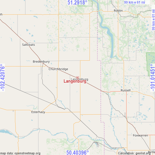
Langenburg GPS coordinates[2]
50° 50' 59.964" North, 101° 43' 3.468" West
| Map corner | latitude | longitude |
|---|---|---|
| Upper-left | 51.2918°, | -102.42076° |
| Center: | 50.84999°, | -101.71763° |
| Lower-right: | 50.40396°, | -101.01451° |
| Map W x H: | 98.7×98.7 km | = 61.3×61.3mi |
| max Lat: | 73.03752° ⇑18.4% North |
| Langenburg: | 50.84999° |
| min Lat: | ⇓81.6% South 42.05009° |
| min Long | Langenburg | max Long |
| -139.43328° | -101.71763° | -52.70931° |
| W 30.5%⇐ | ⇒69.5% E |
Elevation
Elevation of Langenburg is 511 m = 1677 ft, and this is 256.6 m = 842 ft above average elevation for this country.
| Max E: |
1518 m = 4980 ft | 17.8% |
| Langenburg | 511 m 1677 ft | |
| Avg. | 254.4 m = 835 ft | |
Min E: |
-2 m = -7 ft | 82.2% |
See also: Canada elevation on elevation.city.
Geographical zone
Langenburg is located in North temperate zone (between Tropic of Cancer and the Arctic Circle). Distance of this North polar circle is 1747.2 km =1085.7 mi to North.| Distance of | km | miles | from Langenburg |
|---|---|---|---|
| North Pole | 4353.1 | 2704.9 | to North |
| Arctic Circle | 1747.2 | 1085.7 | to North |
| Tropic Cancer | 3048.1 | 1894 | to South |
| Equator | 5654 | 3513.2 | to South |


Nearby cities:
15 places around Langenburg: (largest is in red/bold)
• Canora
100.4 km =62.4 mi,  330°
330°
• Carlyle
140.8 km =87.5 mi,  196°
196°
• Dauphin
121.3 km =75.4 mi,  74°
74°
• Esterhazy
34.1 km =21.2 mi,  229°
229°
• Grenfell
98.4 km =61.1 mi,  240°
240°
• Indian Head
141.8 km =88.1 mi,  255°
255°
• Kamsack
80.7 km =50.1 mi,  350°
350°
• Kipling
105.6 km =65.6 mi,  217°
217°
• Melville
76.4 km =47.5 mi,  275°
275°
• Moosomin
79.8 km =49.6 mi,  177°
177°
• Preeceville
138.9 km =86.3 mi, 331°
• Rivers
138.7 km =86.2 mi,  131°
131°
• Roblin
49.2 km =30.6 mi,  30°
30°
• Virden
124.3 km =77.2 mi,  153°
153°
• Yorkton
66.4 km =41.3 mi,  307°
307°
Sources, notices
• [Note1] Compared only with cities in Canada existing in our database
• [Src1] Map data: © OpenStreetMap contributors (CC-BY-SA)
• [Src2] Other city data from geonames.org with taken over terms of usage.
• [Src3] Geographical zone / Annual Mean Temperature by Robert A. Rohde @ Wikipedia
