Yorkton geodata
Yorkton (Saskatchewan) is a populated place; located in Canada in America/Regina (GMT-6) time zone. With population of 15,669 people, there are 235 cities with bigger population in this country. Compared to other cities in Canada, 83.2% of cities are located further ↓South; 70.3% of cities are located further →East and 81.9% of cities have lower elevation than Yorkton. Note1


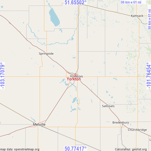
Yorkton GPS coordinates[2]
51° 13' 0.12" North, 102° 28' 3.576" West
| Map corner | latitude | longitude |
|---|---|---|
| Upper-left | 51.65502°, | -103.17079° |
| Center: | 51.2167°, | -102.46766° |
| Lower-right: | 50.77417°, | -101.76454° |
| Map W x H: | 97.9×97.9 km | = 60.8×60.8mi |
| max Lat: | 73.03752° ⇑16.8% North |
| Yorkton: | 51.2167° |
| min Lat: | ⇓83.2% South 42.05009° |
| min Long | Yorkton | max Long |
| -139.43328° | -102.46766° | -52.70931° |
| W 29.7%⇐ | ⇒70.3% E |
Elevation
Elevation of Yorkton is 504 m = 1654 ft, and this is 249.6 m = 819 ft above average elevation for this country.
| Max E: |
1518 m = 4980 ft | 18.1% |
| Yorkton | 504 m 1654 ft | |
| Avg. | 254.4 m = 835 ft | |
Min E: |
-2 m = -7 ft | 81.9% |
See also: Canada elevation on elevation.city.
Geographical zone
Yorkton is located in North temperate zone (between Tropic of Cancer and the Arctic Circle). Distance of this North polar circle is 1706.4 km =1060.3 mi to North.| Distance of | km | miles | from Yorkton |
|---|---|---|---|
| North Pole | 4312.3 | 2679.5 | to North |
| Arctic Circle | 1706.4 | 1060.3 | to North |
| Tropic Cancer | 3088.8 | 1919.3 | to South |
| Equator | 5694.8 | 3538.6 | to South |


Nearby cities:
15 places around Yorkton: (largest is in red/bold)
• Canora
46.4 km =28.8 mi,  2°
2°
• Esterhazy
68.5 km =42.6 mi,  156°
156°
• Foam Lake
88.2 km =54.8 mi,  303°
303°
• Grenfell
94.8 km =58.9 mi,  200°
200°
• Indian Head
113.4 km =70.5 mi,  227°
227°
• Kamsack
55.3 km =34.4 mi,  45°
45°
• Kelvington
128.7 km =80 mi,  325°
325°
• Kipling
124.7 km =77.5 mi,  185°
185°
• Langenburg
66.4 km =41.3 mi,  127°
127°
• Melville
40.7 km =25.3 mi,  214°
214°
• Moosomin
133 km =82.6 mi,  154°
154°
• Preeceville
82.7 km =51.4 mi,  350°
350°
• Roblin
77.4 km =48.1 mi,  88°
88°
• Swan River
128.9 km =80.1 mi,  39°
39°
• Wadena
123 km =76.4 mi,  311°
311°
Sources, notices
• [Note1] Compared only with cities in Canada existing in our database
• [Src1] Map data: © OpenStreetMap contributors (CC-BY-SA)
• [Src2] Other city data from geonames.org with taken over terms of usage.
• [Src3] Geographical zone / Annual Mean Temperature by Robert A. Rohde @ Wikipedia
