Moosonee geodata
Moosonee (Ontario) is a populated place; located in Canada in America/Toronto (GMT-4) time zone. With population of 1,405 people, there are 885 cities with bigger population in this country. Compared to other cities in Canada, 83.7% of cities are located further ↓South; 57.5% of cities are located further →East and 93.8% of cities have higher elevation than Moosonee. Note1


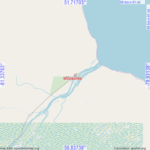
Moosonee GPS coordinates[2]
51° 16' 45.516" North, 80° 38' 4.2" West
| Map corner | latitude | longitude |
|---|---|---|
| Upper-left | 51.71703°, | -81.33763° |
| Center: | 51.27931°, | -80.6345° |
| Lower-right: | 50.83738°, | -79.93138° |
| Map W x H: | 97.8×97.8 km | = 60.8×60.8mi |
| max Lat: | 73.03752° ⇑16.3% North |
| Moosonee: | 51.27931° |
| min Lat: | ⇓83.7% South 42.05009° |
| min Long | Moosonee | max Long |
| -139.43328° | -80.6345° | -52.70931° |
| W 42.5%⇐ | ⇒57.5% E |
Elevation
Elevation of Moosonee is 10 m = 33 ft, and this is 244.4 m = 802 ft below average elevation for this country.
| Max E: |
1518 m = 4980 ft | 93.8% |
| Avg. | 254.4 m = 835 ft | |
| Moosonee | 10 m = 33 ft | |
Min E: |
-2 m = -7 ft | 6.2% |
See also: Canada elevation on elevation.city.
Geographical zone
Moosonee is located in North temperate zone (between Tropic of Cancer and the Arctic Circle). Distance of this North polar circle is 1699.4 km =1056 mi to North.| Distance of | km | miles | from Moosonee |
|---|---|---|---|
| North Pole | 4305.3 | 2675.2 | to North |
| Arctic Circle | 1699.4 | 1056 | to North |
| Tropic Cancer | 3095.8 | 1923.6 | to South |
| Equator | 5701.7 | 3542.9 | to South |


Nearby cities:
15 places around Moosonee: (largest is in red/bold)
• Amos
351.3 km =218.3 mi,  149°
149°
• Attawapiskat
220 km =136.7 mi,  326°
326°
• Englehart
388.9 km =241.7 mi,  171°
171°
• Fort Albany
124.6 km =77.4 mi, 325°
• Hearst
278.4 km =173 mi,  230°
230°
• Iroquois Falls
279.4 km =173.6 mi,  180°
180°
• Kapuskasing
243.2 km =151.1 mi,  211°
211°
• Kirkland Lake
351.2 km =218.2 mi, 172°
• La Sarre
294.1 km =182.7 mi,  159°
159°
• Macamic
304.5 km =189.2 mi, 157°
• Matagami
271.9 km =169 mi,  128°
128°
• Moose Factory
1.9 km =1.2 mi,  137°
137°
• Rouyn-Noranda
357.6 km =222.2 mi, 161°
• Timmins
316.7 km =196.8 mi,  189°
189°
• Waskaganish
132.7 km =82.5 mi,  80°
80°
Sources, notices
• [Note1] Compared only with cities in Canada existing in our database
• [Src1] Map data: © OpenStreetMap contributors (CC-BY-SA)
• [Src2] Other city data from geonames.org with taken over terms of usage.
• [Src3] Geographical zone / Annual Mean Temperature by Robert A. Rohde @ Wikipedia
