Matagami geodata
Matagami (Quebec) is a populated place; located in Canada in America/Toronto (GMT-4) time zone. With population of 1,966 people, there are 757 cities with bigger population in this country. Compared to other cities in Canada, 73.4% of cities are located further ↓South; 52.2% of cities are located further ←West and 65.2% of cities have lower elevation than Matagami. Note1


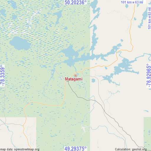
Matagami GPS coordinates[2]
49° 45' 0.648" North, 77° 37' 57.972" West
| Map corner | latitude | longitude |
|---|---|---|
| Upper-left | 50.20236°, | -78.3359° |
| Center: | 49.75018°, | -77.63277° |
| Lower-right: | 49.29375°, | -76.92965° |
| Map W x H: | 101×101 km | = 62.8×62.8mi |
| max Lat: | 73.03752° ⇑26.6% North |
| Matagami: | 49.75018° |
| min Lat: | ⇓73.4% South 42.05009° |
| min Long | Matagami | max Long |
| -139.43328° | -77.63277° | -52.70931° |
| W 52.2%⇐ | ⇒47.8% E |
Elevation
Elevation of Matagami is 257 m = 843 ft, and this is 2.6 m = 9 ft above average elevation for this country.
| Max E: |
1518 m = 4980 ft | 34.8% |
| Matagami | 257 m 843 ft | |
| Avg. | 254.4 m = 835 ft | |
Min E: |
-2 m = -7 ft | 65.2% |
See also: Canada elevation on elevation.city.
Geographical zone
Matagami is located in North temperate zone (between Tropic of Cancer and the Arctic Circle). Distance of this North polar circle is 1869.5 km =1161.7 mi to North.| Distance of | km | miles | from Matagami |
|---|---|---|---|
| North Pole | 4475.4 | 2780.9 | to North |
| Arctic Circle | 1869.5 | 1161.7 | to North |
| Tropic Cancer | 2925.8 | 1818 | to South |
| Equator | 5531.7 | 3437.2 | to South |


Nearby cities:
15 places around Matagami: (largest is in red/bold)
• Amos
136.2 km =84.6 mi,  194°
194°
• Barraute
146.4 km =91 mi,  180°
180°
• Chapais
199.9 km =124.2 mi,  88°
88°
• Chibougamau
235 km =146 mi, 85°
• Iroquois Falls
246.9 km =153.4 mi,  243°
243°
• La Sarre
155.2 km =96.4 mi,  227°
227°
• Lebel-sur-Quévillon
90.9 km =56.5 mi,  148°
148°
• Macamic
149 km =92.6 mi,  221°
221°
• Malartic
183.4 km =114 mi, 191°
• Rouyn-Noranda
196.5 km =122.1 mi,  211°
211°
• Scott
219.1 km =136.1 mi, 88°
• Senneterre
153.6 km =95.4 mi,  169°
169°
• Val-d'Or
184.2 km =114.5 mi, 183°
• Waskaganish
208.2 km =129.4 mi,  337°
337°
• Waswanipi
105.4 km =65.5 mi, 91°
Sources, notices
• [Note1] Compared only with cities in Canada existing in our database
• [Src1] Map data: © OpenStreetMap contributors (CC-BY-SA)
• [Src2] Other city data from geonames.org with taken over terms of usage.
• [Src3] Geographical zone / Annual Mean Temperature by Robert A. Rohde @ Wikipedia
