Waskaganish geodata
Waskaganish (Quebec) is a populated place; located in Canada in America/Toronto (GMT-4) time zone. With population of 1,839 people, there are 783 cities with bigger population in this country. Compared to other cities in Canada, 84.3% of cities are located further ↓South; 50.8% of cities are located further ←West and 85.4% of cities have higher elevation than Waskaganish. Note1


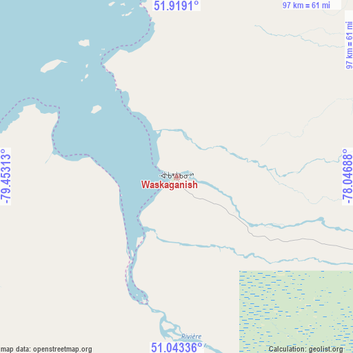
Waskaganish GPS coordinates[2]
51° 28' 59.988" North, 78° 45' 0" West
| Map corner | latitude | longitude |
|---|---|---|
| Upper-left | 51.9191°, | -79.45313° |
| Center: | 51.48333°, | -78.75° |
| Lower-right: | 51.04336°, | -78.04688° |
| Map W x H: | 97.4×97.4 km | = 60.5×60.5mi |
| max Lat: | 73.03752° ⇑15.7% North |
| Waskaganish: | 51.48333° |
| min Lat: | ⇓84.3% South 42.05009° |
| min Long | Waskaganish | max Long |
| -139.43328° | -78.75° | -52.70931° |
| W 50.8%⇐ | ⇒49.2% E |
Elevation
Elevation of Waskaganish is 21 m = 69 ft, and this is 233.4 m = 766 ft below average elevation for this country.
| Max E: |
1518 m = 4980 ft | 85.4% |
| Avg. | 254.4 m = 835 ft | |
| Waskaganish | 21 m = 69 ft | |
Min E: |
-2 m = -7 ft | 14.6% |
See also: Canada elevation on elevation.city.
Geographical zone
Waskaganish is located in North temperate zone (between Tropic of Cancer and the Arctic Circle). Distance of this North polar circle is 1676.8 km =1041.9 mi to North.| Distance of | km | miles | from Waskaganish |
|---|---|---|---|
| North Pole | 4282.7 | 2661.1 | to North |
| Arctic Circle | 1676.8 | 1041.9 | to North |
| Tropic Cancer | 3118.5 | 1937.7 | to South |
| Equator | 5724.4 | 3557 | to South |


Nearby cities:
15 places around Waskaganish: (largest is in red/bold)
• Amos
327.4 km =203.4 mi,  172°
172°
• Attawapiskat
297 km =184.5 mi,  302°
302°
• Barraute
348.4 km =216.5 mi, 166°
• Fort Albany
215.6 km =134 mi,  291°
291°
• Iroquois Falls
332 km =206.3 mi,  204°
204°
• La Sarre
300.1 km =186.5 mi,  186°
186°
• Lebel-sur-Quévillon
298.3 km =185.4 mi,  155°
155°
• Macamic
304.4 km =189.1 mi,  183°
183°
• Malartic
375.1 km =233.1 mi, 173°
• Matagami
208.2 km =129.4 mi, 157°
• Moose Factory
131.7 km =81.8 mi,  259°
259°
• Moosonee
132.7 km =82.5 mi, 260°
• Rouyn-Noranda
361.5 km =224.6 mi, 183°
• Senneterre
360.2 km =223.8 mi, 162°
• Waswanipi
266.6 km =165.7 mi,  136°
136°
Sources, notices
• [Note1] Compared only with cities in Canada existing in our database
• [Src1] Map data: © OpenStreetMap contributors (CC-BY-SA)
• [Src2] Other city data from geonames.org with taken over terms of usage.
• [Src3] Geographical zone / Annual Mean Temperature by Robert A. Rohde @ Wikipedia
