Nanton geodata
Nanton (Alberta) is a populated place; located in Canada in America/Edmonton (GMT-6) time zone. With population of 1,936 people, there are 763 cities with bigger population in this country. Compared to other cities in Canada, 78.4% of cities are located further ↓South; 80.4% of cities are located further →East and 97.6% of cities have lower elevation than Nanton. Note1


Nanton GPS coordinates[2]
50° 21' 0.288" North, 113° 46' 7.176" West
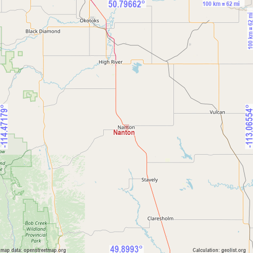
| Map corner | latitude | longitude |
|---|---|---|
| Upper-left | 50.79662°, | -114.47179° |
| Center: | 50.35008°, | -113.76866° |
| Lower-right: | 49.8993°, | -113.06554° |
| Map W x H: | 99.8×99.8 km | = 62×62mi |
| max Lat: | 73.03752° ⇑21.6% North |
| Nanton: | 50.35008° |
| min Lat: | ⇓78.4% South 42.05009° |
| min Long | Nanton | max Long |
| -139.43328° | -113.76866° | -52.70931° |
| W 19.6%⇐ | ⇒80.4% E |
Elevation
Elevation of Nanton is 1019 m = 3343 ft, and this is 764.6 m = 2509 ft above average elevation for this country.
| Max E: |
1518 m = 4980 ft | 2.4% |
| Nanton | 1019 m 3343 ft | |
| Avg. | 254.4 m = 835 ft | |
Min E: |
-2 m = -7 ft | 97.6% |
See also: Canada elevation on elevation.city.
Geographical zone
Nanton is located in North temperate zone (between Tropic of Cancer and the Arctic Circle). Distance of this North polar circle is 1802.8 km =1120.2 mi to North.| Distance of | km | miles | from Nanton |
|---|---|---|---|
| North Pole | 4408.7 | 2739.4 | to North |
| Arctic Circle | 1802.8 | 1120.2 | to North |
| Tropic Cancer | 2992.5 | 1859.5 | to South |
| Equator | 5598.4 | 3478.7 | to South |


Nearby cities:
15 places around Nanton: (largest is in red/bold)
• Black Diamond
51 km =31.7 mi,  319°
319°
• Bragg Creek
87.1 km =54.1 mi, 320°
• Calgary
81 km =50.3 mi,  344°
344°
• Chestermere
76.1 km =47.3 mi,  357°
357°
• Claresholm
37.6 km =23.4 mi,  159°
159°
• Coalhurst
89.8 km =55.8 mi,  138°
138°
• Elkford
86.2 km =53.6 mi,  247°
247°
• Fort Macleod
74.7 km =46.4 mi, 160°
• Heritage Pointe
57.2 km =35.5 mi, 343°
• High River
26.9 km =16.7 mi, 344°
• Okotoks
44.8 km =27.8 mi, 340°
• Picture Butte
87.2 km =54.2 mi,  126°
126°
• Pincher Creek
97.3 km =60.5 mi,  187°
187°
• Strathmore
82.4 km =51.2 mi,  19°
19°
• Vulcan
37.1 km =23.1 mi,  81°
81°
Sources, notices
• [Note1] Compared only with cities in Canada existing in our database
• [Src1] Map data: © OpenStreetMap contributors (CC-BY-SA)
• [Src2] Other city data from geonames.org with taken over terms of usage.
• [Src3] Geographical zone / Annual Mean Temperature by Robert A. Rohde @ Wikipedia
