Parry Sound geodata
Parry Sound (Ontario) is a populated place; located in Canada in America/Toronto (GMT-4) time zone. With population of 6,321 people, there are 419 cities with bigger population in this country. Compared to other cities in Canada, 79.8% of cities are located further ↑North; 55.6% of cities are located further →East and 54.9% of cities have lower elevation than Parry Sound. Note1


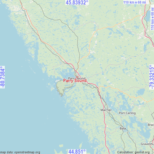
Parry Sound GPS coordinates[2]
45° 20' 50.352" North, 80° 2' 6.972" West
| Map corner | latitude | longitude |
|---|---|---|
| Upper-left | 45.83932°, | -80.7384° |
| Center: | 45.34732°, | -80.03527° |
| Lower-right: | 44.851°, | -79.33215° |
| Map W x H: | 109.9×109.9 km | = 68.3×68.3mi |
| max Lat: | 73.03752° ⇑79.8% North |
| Parry Sound: | 45.34732° |
| min Lat: | ⇓20.2% South 42.05009° |
| min Long | Parry Sound | max Long |
| -139.43328° | -80.03527° | -52.70931° |
| W 44.4%⇐ | ⇒55.6% E |
Elevation
Elevation of Parry Sound is 199 m = 653 ft, and this is 55.4 m = 182 ft below average elevation for this country.
| Max E: |
1518 m = 4980 ft | 45.1% |
| Avg. | 254.4 m = 835 ft | |
| Parry Sound | 199 m = 653 ft | |
Min E: |
-2 m = -7 ft | 54.9% |
See also: Canada elevation on elevation.city.
Geographical zone
Parry Sound is located in North temperate zone (between Tropic of Cancer and the Arctic Circle). Distance of this North polar circle is 2359 km =1465.8 mi to North.| Distance of | km | miles | from Parry Sound |
|---|---|---|---|
| North Pole | 4964.9 | 3085 | to North |
| Arctic Circle | 2359 | 1465.8 | to North |
| Tropic Cancer | 2436.2 | 1513.8 | to South |
| Equator | 5042.1 | 3133 | to South |


Nearby cities:
15 places around Parry Sound: (largest is in red/bold)
• Amigo Beach
87.6 km =54.4 mi,  145°
145°
• Anten Mills
97.8 km =60.8 mi,  169°
169°
• Barrie
109.3 km =67.9 mi,  164°
164°
• Bracebridge
66.3 km =41.2 mi,  121°
121°
• Collingwood
97.1 km =60.3 mi,  188°
188°
• Elmvale
86 km =53.4 mi, 171°
• Gravenhurst
71 km =44.1 mi,  132°
132°
• Huntsville
64 km =39.8 mi,  91°
91°
• Meaford
93.9 km =58.3 mi,  208°
208°
• Midland
67.5 km =41.9 mi, 169°
• Orillia
95.3 km =59.2 mi, 149°
• Patrick Fogarty Catholic Secondary School
93.3 km =58 mi, 149°
• Powassan
93 km =57.8 mi,  34°
34°
• South River
74.1 km =46 mi,  43°
43°
• Wasaga Beach
92.4 km =57.4 mi,  179°
179°
Sources, notices
• [Note1] Compared only with cities in Canada existing in our database
• [Src1] Map data: © OpenStreetMap contributors (CC-BY-SA)
• [Src2] Other city data from geonames.org with taken over terms of usage.
• [Src3] Geographical zone / Annual Mean Temperature by Robert A. Rohde @ Wikipedia
