Saint-Alexandre geodata
Saint-Alexandre (Quebec) is a populated place; located in Canada in America/Toronto (GMT-4) time zone. With population of 1,093 people, there are 1005 cities with bigger population in this country. Compared to other cities in Canada, 75.7% of cities are located further ↓South; 86.3% of cities are located further ←West and 91.2% of cities have higher elevation than Saint-Alexandre. Note1


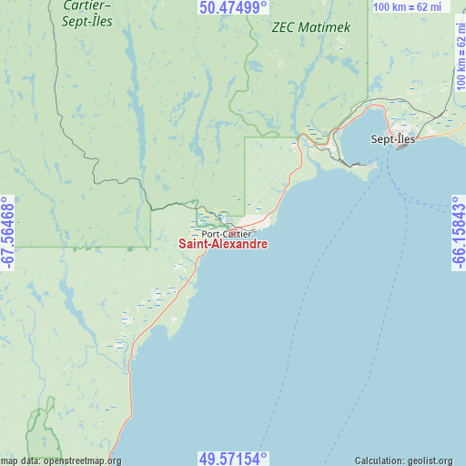
Saint-Alexandre GPS coordinates[2]
50° 1' 31.404" North, 66° 51' 41.58" West
| Map corner | latitude | longitude |
|---|---|---|
| Upper-left | 50.47499°, | -67.56468° |
| Center: | 50.02539°, | -66.86155° |
| Lower-right: | 49.57154°, | -66.15843° |
| Map W x H: | 100.5×100.5 km | = 62.4×62.4mi |
| max Lat: | 73.03752° ⇑24.3% North |
| Saint-Alexandre: | 50.02539° |
| min Lat: | ⇓75.7% South 42.05009° |
| min Long | Saint-Alexandre | max Long |
| -139.43328° | -66.86155° | -52.70931° |
| W 86.3%⇐ | ⇒13.7% E |
Elevation
Elevation of Saint-Alexandre is 13 m = 43 ft, and this is 241.4 m = 792 ft below average elevation for this country.
| Max E: |
1518 m = 4980 ft | 91.2% |
| Avg. | 254.4 m = 835 ft | |
| Saint-Alexandre | 13 m = 43 ft | |
Min E: |
-2 m = -7 ft | 8.8% |
See also: Canada elevation on elevation.city.
Geographical zone
Saint-Alexandre is located in North temperate zone (between Tropic of Cancer and the Arctic Circle). Distance of this North polar circle is 1838.9 km =1142.6 mi to North.| Distance of | km | miles | from Saint-Alexandre |
|---|---|---|---|
| North Pole | 4444.8 | 2761.9 | to North |
| Arctic Circle | 1838.9 | 1142.6 | to North |
| Tropic Cancer | 2956.4 | 1837 | to South |
| Equator | 5562.3 | 3456.3 | to South |


Nearby cities:
15 places around Saint-Alexandre: (largest is in red/bold)
• Amqui
178.5 km =110.9 mi,  193°
193°
• Baie-Comeau
129.2 km =80.3 mi,  225°
225°
• Cap-Chat
103.7 km =64.4 mi,  172°
172°
• Chute-aux-Outardes
150 km =93.2 mi, 227°
• Godefroy
210 km =130.5 mi,  335°
335°
• Hauterive
136.5 km =84.8 mi, 227°
• Labrieville
210.5 km =130.8 mi,  247°
247°
• Luceville
198.7 km =123.5 mi,  214°
214°
• Maliotenam
52.7 km =32.7 mi,  66°
66°
• Matane
141.4 km =87.9 mi,  199°
199°
• Mont-Joli
187.1 km =116.3 mi, 211°
• Murdochville
154.1 km =95.8 mi,  140°
140°
• Port-Cartier
0.9 km =0.6 mi, 342°
• Sainte-Anne-des-Monts
103.7 km =64.4 mi, 165°
• Sept-Îles
39.3 km =24.4 mi,  60°
60°
Sources, notices
• [Note1] Compared only with cities in Canada existing in our database
• [Src1] Map data: © OpenStreetMap contributors (CC-BY-SA)
• [Src2] Other city data from geonames.org with taken over terms of usage.
• [Src3] Geographical zone / Annual Mean Temperature by Robert A. Rohde @ Wikipedia
