Godefroy geodata
Godefroy (Quebec) is a populated place; located in Canada in America/Toronto (GMT-4) time zone. With population of 1,410 people, there are 884 cities with bigger population in this country. Compared to other cities in Canada, 85.2% of cities are located further ↓South; 85.2% of cities are located further ←West and 79.6% of cities have lower elevation than Godefroy. Note1


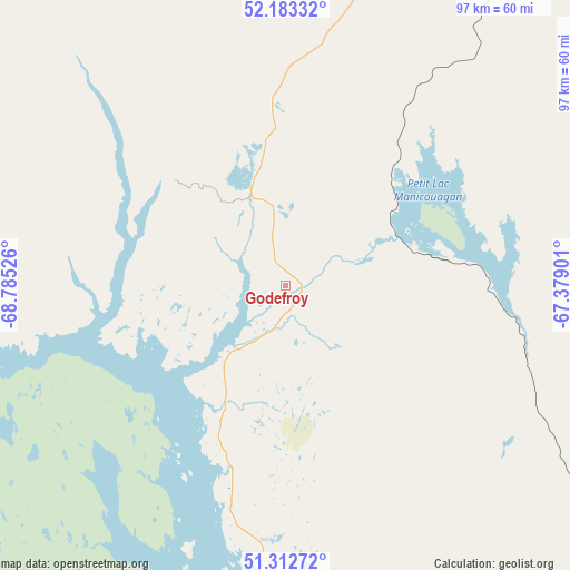
Godefroy GPS coordinates[2]
51° 45' 0.432" North, 68° 4' 55.668" West
| Map corner | latitude | longitude |
|---|---|---|
| Upper-left | 52.18332°, | -68.78526° |
| Center: | 51.75012°, | -68.08213° |
| Lower-right: | 51.31272°, | -67.37901° |
| Map W x H: | 96.8×96.8 km | = 60.1×60.1mi |
| max Lat: | 73.03752° ⇑14.8% North |
| Godefroy: | 51.75012° |
| min Lat: | ⇓85.2% South 42.05009° |
| min Long | Godefroy | max Long |
| -139.43328° | -68.08213° | -52.70931° |
| W 85.2%⇐ | ⇒14.8% E |
Elevation
Elevation of Godefroy is 432 m = 1417 ft, and this is 177.6 m = 583 ft above average elevation for this country.
| Max E: |
1518 m = 4980 ft | 20.4% |
| Godefroy | 432 m 1417 ft | |
| Avg. | 254.4 m = 835 ft | |
Min E: |
-2 m = -7 ft | 79.6% |
See also: Canada elevation on elevation.city.
Geographical zone
Godefroy is located in North temperate zone (between Tropic of Cancer and the Arctic Circle). Distance of this North polar circle is 1647.1 km =1023.5 mi to North.| Distance of | km | miles | from Godefroy |
|---|---|---|---|
| North Pole | 4253 | 2642.7 | to North |
| Arctic Circle | 1647.1 | 1023.5 | to North |
| Tropic Cancer | 3148.2 | 1956.2 | to South |
| Equator | 5754.1 | 3575.4 | to South |


Nearby cities:
15 places around Godefroy: (largest is in red/bold)
• Baie-Comeau
281.7 km =175 mi,  180°
180°
• Cap-Chat
310.9 km =193.2 mi,  161°
161°
• Chute-aux-Outardes
293.7 km =182.5 mi, 184°
• Fermont
133.5 km =83 mi,  30°
30°
• Forestville
342.4 km =212.8 mi,  192°
192°
• Hauterive
284.3 km =176.7 mi, 182°
• Labrador City
155 km =96.3 mi, 30°
• Labrieville
291.8 km =181.3 mi,  201°
201°
• Maliotenam
216.7 km =134.7 mi,  142°
142°
• Matane
327.3 km =203.4 mi,  173°
173°
• Mont-Joli
352.1 km =218.8 mi, 181°
• Port-Cartier
209.1 km =129.9 mi, 155°
• Saint-Alexandre
210 km =130.5 mi, 155°
• Sainte-Anne-des-Monts
312.9 km =194.4 mi, 158°
• Sept-Îles
209.4 km =130.1 mi,  145°
145°
Sources, notices
• [Note1] Compared only with cities in Canada existing in our database
• [Src1] Map data: © OpenStreetMap contributors (CC-BY-SA)
• [Src2] Other city data from geonames.org with taken over terms of usage.
• [Src3] Geographical zone / Annual Mean Temperature by Robert A. Rohde @ Wikipedia
