Waswanipi geodata
Waswanipi (Quebec) is a populated place; located in Canada in America/Toronto (GMT-4) time zone. With population of 1,473 people, there are 870 cities with bigger population in this country. Compared to other cities in Canada, 73.1% of cities are located further ↓South; 54.4% of cities are located further ←West and 70.3% of cities have lower elevation than Waswanipi. Note1


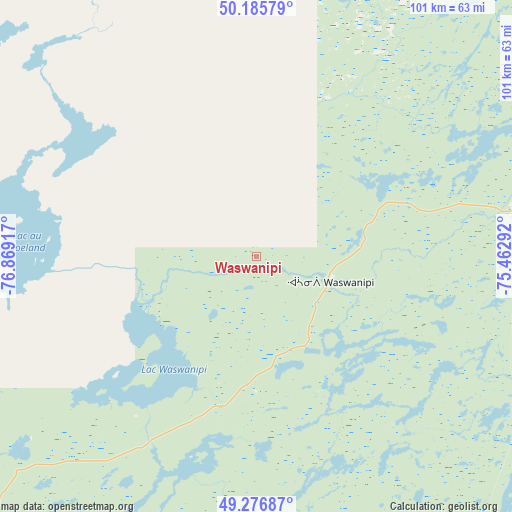
Waswanipi GPS coordinates[2]
49° 44' 0.456" North, 76° 9' 57.744" West
| Map corner | latitude | longitude |
|---|---|---|
| Upper-left | 50.18579°, | -76.86917° |
| Center: | 49.73346°, | -76.16604° |
| Lower-right: | 49.27687°, | -75.46292° |
| Map W x H: | 101.1×101.1 km | = 62.8×62.8mi |
| max Lat: | 73.03752° ⇑26.9% North |
| Waswanipi: | 49.73346° |
| min Lat: | ⇓73.1% South 42.05009° |
| min Long | Waswanipi | max Long |
| -139.43328° | -76.16604° | -52.70931° |
| W 54.4%⇐ | ⇒45.6% E |
Elevation
Elevation of Waswanipi is 307 m = 1007 ft, and this is 52.6 m = 173 ft above average elevation for this country.
| Max E: |
1518 m = 4980 ft | 29.7% |
| Waswanipi | 307 m 1007 ft | |
| Avg. | 254.4 m = 835 ft | |
Min E: |
-2 m = -7 ft | 70.3% |
See also: Canada elevation on elevation.city.
Geographical zone
Waswanipi is located in North temperate zone (between Tropic of Cancer and the Arctic Circle). Distance of this North polar circle is 1871.3 km =1162.8 mi to North.| Distance of | km | miles | from Waswanipi |
|---|---|---|---|
| North Pole | 4477.2 | 2782 | to North |
| Arctic Circle | 1871.3 | 1162.8 | to North |
| Tropic Cancer | 2923.9 | 1816.8 | to South |
| Equator | 5529.8 | 3436.1 | to South |


Nearby cities:
15 places around Waswanipi: (largest is in red/bold)
• Amos
192.2 km =119.4 mi,  227°
227°
• Barraute
179.7 km =111.7 mi,  216°
216°
• Chapais
94.8 km =58.9 mi,  86°
86°
• Chibougamau
130.7 km =81.2 mi,  81°
81°
• La Sarre
243.3 km =151.2 mi,  244°
244°
• Lebel-sur-Quévillon
96.3 km =59.8 mi, 217°
• Leblanc
210.1 km =130.6 mi,  140°
140°
• Macamic
232.9 km =144.7 mi, 242°
• Malartic
228.6 km =142 mi, 218°
• Matagami
105.4 km =65.5 mi,  271°
271°
• Mistissini
179.7 km =111.7 mi,  64°
64°
• Scott
114.1 km =70.9 mi, 85°
• Senneterre
168.3 km =104.6 mi,  207°
207°
• Val-d'Or
217.5 km =135.1 mi, 213°
• Waskaganish
266.6 km =165.7 mi,  316°
316°
Sources, notices
• [Note1] Compared only with cities in Canada existing in our database
• [Src1] Map data: © OpenStreetMap contributors (CC-BY-SA)
• [Src2] Other city data from geonames.org with taken over terms of usage.
• [Src3] Geographical zone / Annual Mean Temperature by Robert A. Rohde @ Wikipedia
