Kisangani geodata
Kisangani (Tshopo) is a seat of a first-order administrative division; located in Democratic Republic of the Congo in Africa/Lubumbashi (GMT+2) time zone. With population of 539,158 people, there are 3 cities with bigger population in this country. Compared to other cities in Democratic Republic of the Congo, 75.7% of cities are located further ↓South; 65.7% of cities are located further ←West and 70% of cities have higher elevation than Kisangani. Note1


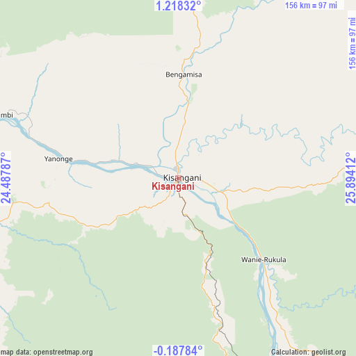
Kisangani GPS coordinates[2]
0° 30' 55.008" North, 25° 11' 27.564" East
| Map corner | latitude | longitude |
|---|---|---|
| Upper-left | 1.21832°, | 24.48787° |
| Center: | 0.51528°, | 25.19099° |
| Lower-right: | -0.18784°, | 25.89412° |
| Map W x H: | 156.4×156.4 km | = 97.2×97.2mi |
| max Lat: | 4.279° ⇑24.3% North |
| Kisangani: | 0.51528° |
| min Lat: | ⇓75.7% South -11.76097° |
| min Long | Kisangani | max Long |
| 12.37148° | 25.19099° | 30.25224° |
| W 65.7%⇐ | ⇒34.3% E |
Elevation
Elevation of Kisangani is 400 m = 1312 ft, and this is 256 m = 840 ft below average elevation for this country.
| Max E: |
1996 m = 6549 ft | 70% |
| Avg. | 656 m = 2152 ft | |
| Kisangani | 400 m = 1312 ft | |
Min E: |
11 m = 36 ft | 30% |
See also: Kisangani elevation on elevation.city.
Geographical zone
Kisangani is located in North Torrid zone (between Equator and Tropic of Cancer). Distance of Equator is 57.3 km =35.6 mi to South.| Distance of | km | miles | from Kisangani |
|---|---|---|---|
| North Pole | 9949.8 | 6182.5 | to North |
| Arctic Circle | 7343.9 | 4563.3 | to North |
| Tropic Cancer | 2548.6 | 1583.6 | to North |
| Equator | 57.3 | 35.6 | to South |


Nearby cities:
9 places around Kisangani: (largest is in red/bold)
• Aketi
292.6 km =181.8 mi,  327°
327°
• Basoko
192.7 km =119.7 mi,  294°
294°
• Bondo
403.1 km =250.5 mi,  335°
335°
• Bumba
355.2 km =220.7 mi,  301°
301°
• Buta
257.6 km =160.1 mi,  348°
348°
• Isiro
368.4 km =228.9 mi,  47°
47°
• Kindu
393.1 km =244.3 mi,  168°
168°
• Wamba
360.7 km =224.1 mi,  59°
59°
• Yangambi
88.1 km =54.7 mi, 288°
Sources, notices
• [Note1] Compared only with cities in Democratic Republic of the Congo existing in our database
• [Src1] Map data: © OpenStreetMap contributors (CC-BY-SA)
• [Src2] Other city data from geonames.org with taken over terms of usage.
• [Src3] Geographical zone / Annual Mean Temperature by Robert A. Rohde @ Wikipedia
