Buta geodata
Buta (Bas-Uele) is a seat of a first-order administrative division; located in Democratic Republic of the Congo in Africa/Lubumbashi (GMT+2) time zone. With population of 50,130 people, there are 37 cities with bigger population in this country. Compared to other cities in Democratic Republic of the Congo, 90% of cities are located further ↓South; 62.9% of cities are located further ←West and 67.1% of cities have higher elevation than Buta. Note1


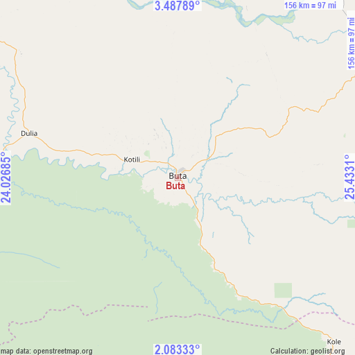
Buta GPS coordinates[2]
2° 47' 8.952" North, 24° 43' 47.892" East
| Map corner | latitude | longitude |
|---|---|---|
| Upper-left | 3.48789°, | 24.02685° |
| Center: | 2.78582°, | 24.72997° |
| Lower-right: | 2.08333°, | 25.4331° |
| Map W x H: | 156.2×156.2 km | = 97.1×97.1mi |
| max Lat: | 4.279° ⇑10% North |
| Buta: | 2.78582° |
| min Lat: | ⇓90% South -11.76097° |
| min Long | Buta | max Long |
| 12.37148° | 24.72997° | 30.25224° |
| W 62.9%⇐ | ⇒37.1% E |
Elevation
Elevation of Buta is 402 m = 1319 ft, and this is 254 m = 833 ft below average elevation for this country.
| Max E: |
1996 m = 6549 ft | 67.1% |
| Avg. | 656 m = 2152 ft | |
| Buta | 402 m = 1319 ft | |
Min E: |
11 m = 36 ft | 32.9% |
See also: Buta elevation on elevation.city.
Geographical zone
Buta is located in North Torrid zone (between Equator and Tropic of Cancer). Distance of Equator is 309.8 km =192.5 mi to South.| Distance of | km | miles | from Buta |
|---|---|---|---|
| North Pole | 9697.3 | 6025.6 | to North |
| Arctic Circle | 7091.4 | 4406.4 | to North |
| Tropic Cancer | 2296.2 | 1426.8 | to North |
| Equator | 309.8 | 192.5 | to South |


Nearby cities:
11 places around Buta: (largest is in red/bold)
• Aketi
105.3 km =65.4 mi,  267°
267°
• Basoko
211.9 km =131.7 mi,  215°
215°
• Bondo
162.8 km =101.2 mi,  314°
314°
• Bongandanga
430.5 km =267.5 mi,  250°
250°
• Bumba
259.9 km =161.5 mi,  255°
255°
• Businga
431.2 km =267.9 mi,  278°
278°
• Isiro
320.5 km =199.1 mi,  90°
90°
• Kisangani
257.6 km =160.1 mi,  168°
168°
• Lisala
363.9 km =226.1 mi, 258°
• Wamba
369.5 km =229.6 mi,  101°
101°
• Yangambi
226.7 km =140.9 mi,  188°
188°
Sources, notices
• [Note1] Compared only with cities in Democratic Republic of the Congo existing in our database
• [Src1] Map data: © OpenStreetMap contributors (CC-BY-SA)
• [Src2] Other city data from geonames.org with taken over terms of usage.
• [Src3] Geographical zone / Annual Mean Temperature by Robert A. Rohde @ Wikipedia
