Aketi geodata
Aketi (Bas-Uele) is a populated place; located in Democratic Republic of the Congo in Africa/Lubumbashi (GMT+2) time zone. With population of 35,161 people, there are 53 cities with bigger population in this country. Compared to other cities in Democratic Republic of the Congo, 87.1% of cities are located further ↓South; 57.1% of cities are located further ←West and 72.9% of cities have higher elevation than Aketi. Note1


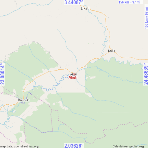
Aketi GPS coordinates[2]
2° 44' 19.572" North, 23° 46' 59.736" East
| Map corner | latitude | longitude |
|---|---|---|
| Upper-left | 3.44087°, | 23.08014° |
| Center: | 2.73877°, | 23.78326° |
| Lower-right: | 2.03626°, | 24.48639° |
| Map W x H: | 156.2×156.2 km | = 97.1×97.1mi |
| max Lat: | 4.279° ⇑12.9% North |
| Aketi: | 2.73877° |
| min Lat: | ⇓87.1% South -11.76097° |
| min Long | Aketi | max Long |
| 12.37148° | 23.78326° | 30.25224° |
| W 57.1%⇐ | ⇒42.9% E |
Elevation
Elevation of Aketi is 380 m = 1247 ft, and this is 276 m = 906 ft below average elevation for this country.
| Max E: |
1996 m = 6549 ft | 72.9% |
| Avg. | 656 m = 2152 ft | |
| Aketi | 380 m = 1247 ft | |
Min E: |
11 m = 36 ft | 27.1% |
See also: Democratic Republic of the Congo elevation on elevation.city.
Geographical zone
Aketi is located in North Torrid zone (between Equator and Tropic of Cancer). Distance of Equator is 304.5 km =189.2 mi to South.| Distance of | km | miles | from Aketi |
|---|---|---|---|
| North Pole | 9702.5 | 6028.9 | to North |
| Arctic Circle | 7096.7 | 4409.7 | to North |
| Tropic Cancer | 2301.4 | 1430 | to North |
| Equator | 304.5 | 189.2 | to South |


Nearby cities:
11 places around Aketi: (largest is in red/bold)
• Basoko
167.8 km =104.3 mi,  186°
186°
• Bondo
120.1 km =74.6 mi,  354°
354°
• Bongandanga
330.9 km =205.6 mi,  245°
245°
• Bumba
158.4 km =98.4 mi, 247°
• Businga
328.6 km =204.2 mi,  281°
281°
• Buta
105.3 km =65.4 mi,  87°
87°
• Gbadolite
352.9 km =219.3 mi,  299°
299°
• Isiro
425.7 km =264.5 mi, 89°
• Kisangani
292.6 km =181.8 mi,  147°
147°
• Lisala
260.1 km =161.6 mi,  255°
255°
• Yangambi
231 km =143.5 mi,  161°
161°
Sources, notices
• [Note1] Compared only with cities in Democratic Republic of the Congo existing in our database
• [Src1] Map data: © OpenStreetMap contributors (CC-BY-SA)
• [Src2] Other city data from geonames.org with taken over terms of usage.
• [Src3] Geographical zone / Annual Mean Temperature by Robert A. Rohde @ Wikipedia
