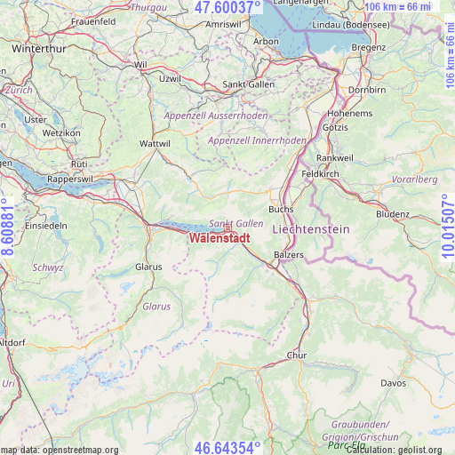
Walenstadt geodata
Walenstadt (Saint Gallen) is a populated place; located in Switzerland in Europe/Zurich (GMT+2) time zone. With population of 5,000 people, there are 343 cities with bigger population in this country. Compared to other cities in Switzerland, 57.8% of cities are located further ↑North; 94.2% of cities are located further ←West and 77.8% of cities have higher elevation than Walenstadt. Note1
Administrative division(s):
- Level 1: Saint Gallen
- Level 2: Wahlkreis Sarganserland
- Level 3: Walenstadt


Walenstadt GPS coordinates[2]
47° 7' 26.796" North, 9° 18' 42.984" East
| Map corner | latitude | longitude |
|---|---|---|
| Upper-left | 47.60037°, | 8.60881° |
| Center: | 47.12411°, | 9.31194° |
| Lower-right: | 46.64354°, | 10.01507° |
| Map W x H: | 106.4×106.4 km | = 66.1×66.1mi |
| max Lat: | 47.76737° ⇑57.8% North |
| Walenstadt: | 47.12411° |
| min Lat: | ⇓42.2% South 45.83203° |
| min Long | Walenstadt | max Long |
| 5.97153° | 9.31194° | 10.44624° |
| W 94.2%⇐ | ⇒5.8% E |
Elevation
Elevation of Walenstadt is 426 m = 1398 ft, and this is 132.2 m = 434 ft below average elevation for this country.
| Max E: |
1845 m = 6053 ft | 77.8% |
| Avg. | 558.2 m = 1831 ft | |
| Walenstadt | 426 m = 1398 ft | |
Min E: |
197 m = 646 ft | 22.2% |
See also: Switzerland elevation on elevation.city.
Geographical zone
Walenstadt is located in North temperate zone (between Tropic of Cancer and the Arctic Circle). Distance of this North polar circle is 2161.5 km =1343.1 mi to North.| Distance of | km | miles | from Walenstadt |
|---|---|---|---|
| North Pole | 4767.4 | 2962.3 | to North |
| Arctic Circle | 2161.5 | 1343.1 | to North |
| Tropic Cancer | 2633.8 | 1636.6 | to South |
| Equator | 5239.7 | 3255.8 | to South |


Nearby cities:
15 places around Walenstadt: (largest is in red/bold)
• Amden
13.1 km =8.1 mi,  282°
282°
• Buchs
13.4 km =8.3 mi,  69°
69°
• Filzbach
13.6 km =8.5 mi,  267°
267°
• Flums
4.4 km =2.7 mi,  147°
147°
• Gams
13.3 km =8.3 mi,  47°
47°
• Grabs
11.9 km =7.4 mi,  56°
56°
• Haag (Rheintal)
16.5 km =10.3 mi, 54°
• Krummenau
17.4 km =10.8 mi,  322°
322°
• Mollis
18.5 km =11.5 mi,  257°
257°
• Quarten
5.6 km =3.5 mi,  250°
250°
• Sargans
12.9 km =8 mi,  130°
130°
• Sevelen
13.2 km =8.2 mi,  90°
90°
• Unterwasser
8.1 km =5 mi,  358°
358°
• Weesen
16.3 km =10.1 mi, 274°
• Wildhaus
9.6 km =6 mi,  19°
19°
Sources, notices
• [Note1] Compared only with cities in Switzerland existing in our database
• [Src1] Map data: © OpenStreetMap contributors (CC-BY-SA)
• [Src2] Other city data from geonames.org with taken over terms of usage.
• [Src3] Geographical zone / Annual Mean Temperature by Robert A. Rohde @ Wikipedia
