Krummenau geodata
Krummenau (Saint Gallen) is a populated place; located in Switzerland in Europe/Zurich (GMT+2) time zone. With population of 1,453 people, there are 1056 cities with bigger population in this country. Compared to other cities in Switzerland, 51.6% of cities are located further ↓South; 92.3% of cities are located further ←West and 83.5% of cities have lower elevation than Krummenau. Note1


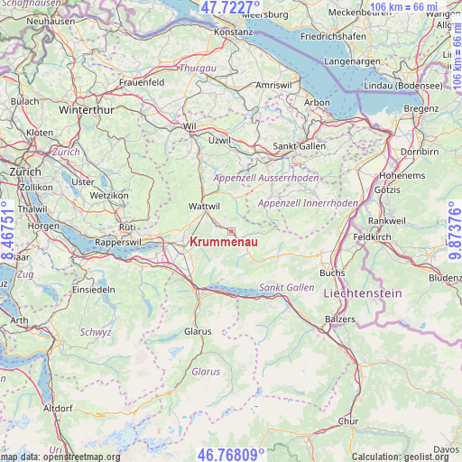
Krummenau GPS coordinates[2]
47° 14' 51.18" North, 9° 10' 14.304" East
| Map corner | latitude | longitude |
|---|---|---|
| Upper-left | 47.7227°, | 8.46751° |
| Center: | 47.24755°, | 9.17064° |
| Lower-right: | 46.76809°, | 9.87376° |
| Map W x H: | 106.1×106.1 km | = 65.9×65.9mi |
| max Lat: | 47.76737° ⇑48.4% North |
| Krummenau: | 47.24755° |
| min Lat: | ⇓51.6% South 45.83203° |
| min Long | Krummenau | max Long |
| 5.97153° | 9.17064° | 10.44624° |
| W 92.3%⇐ | ⇒7.7% E |
Elevation
Elevation of Krummenau is 716 m = 2349 ft, and this is 157.8 m = 518 ft above average elevation for this country.
| Max E: |
1845 m = 6053 ft | 16.5% |
| Krummenau | 716 m 2349 ft | |
| Avg. | 558.2 m = 1831 ft | |
Min E: |
197 m = 646 ft | 83.5% |
See also: Switzerland elevation on elevation.city.
Geographical zone
Krummenau is located in North temperate zone (between Tropic of Cancer and the Arctic Circle). Distance of this North polar circle is 2147.7 km =1334.5 mi to North.| Distance of | km | miles | from Krummenau |
|---|---|---|---|
| North Pole | 4753.6 | 2953.7 | to North |
| Arctic Circle | 2147.7 | 1334.5 | to North |
| Tropic Cancer | 2647.5 | 1645.1 | to South |
| Equator | 5253.4 | 3264.3 | to South |


Nearby cities:
15 places around Krummenau: (largest is in red/bold)
• Amden
11.2 km =7 mi,  191°
191°
• Benken
13.4 km =8.3 mi,  246°
246°
• Brunnadern
10.3 km =6.4 mi,  342°
342°
• Ebnat-Kappel
3.8 km =2.4 mi,  294°
294°
• Gommiswald
11.3 km =7 mi,  260°
260°
• Hemberg
5.9 km =3.7 mi,  3°
3°
• Kaltbrunn
11.6 km =7.2 mi, 250°
• Lichtensteig
10.5 km =6.5 mi,  323°
323°
• Mogelsberg
13 km =8.1 mi,  348°
348°
• Oberhelfenschwil
13 km =8.1 mi, 339°
• Sankt Peterzell
7.8 km =4.8 mi, 2°
• Schwellbrunn
13.1 km =8.1 mi,  26°
26°
• Unterwasser
11.8 km =7.3 mi,  118°
118°
• Urnäsch
11.2 km =7 mi,  46°
46°
• Wattwil
8.6 km =5.3 mi,  312°
312°
Sources, notices
• [Note1] Compared only with cities in Switzerland existing in our database
• [Src1] Map data: © OpenStreetMap contributors (CC-BY-SA)
• [Src2] Other city data from geonames.org with taken over terms of usage.
• [Src3] Geographical zone / Annual Mean Temperature by Robert A. Rohde @ Wikipedia
