Sils-Segl Maria geodata
Sils-Segl Maria (Grisons) is a populated place; located in Switzerland in Europe/Zurich (GMT+2) time zone. With population of 735 people, there are 1553 cities with bigger population in this country. Compared to other cities in Switzerland, 87.5% of cities are located further ↑North; 99% of cities are located further ←West and 99.8% of cities have lower elevation than Sils-Segl Maria. Note1


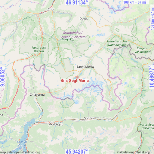
Sils-Segl Maria GPS coordinates[2]
46° 25' 43.896" North, 9° 45' 49.104" East
| Map corner | latitude | longitude |
|---|---|---|
| Upper-left | 46.91134°, | 9.06052° |
| Center: | 46.42886°, | 9.76364° |
| Lower-right: | 45.94207°, | 10.46677° |
| Map W x H: | 107.8×107.8 km | = 67×67mi |
| max Lat: | 47.76737° ⇑87.5% North |
| Sils-Segl Maria: | 46.42886° |
| min Lat: | ⇓12.5% South 45.83203° |
| min Long | Sils-Segl Maria | max Long |
| 5.97153° | 9.76364° | 10.44624° |
| W 99%⇐ | ⇒1% E |
Elevation
Elevation of Sils-Segl Maria is 1812 m = 5945 ft, and this is 1253.8 m = 4114 ft above average elevation for this country.
| Max E: |
1845 m = 6053 ft | 0.2% |
| Sils-Segl Maria | 1812 m 5945 ft | |
| Avg. | 558.2 m = 1831 ft | |
Min E: |
197 m = 646 ft | 99.8% |
See also: Switzerland elevation on elevation.city.
Geographical zone
Sils-Segl Maria is located in North temperate zone (between Tropic of Cancer and the Arctic Circle). Distance of this North polar circle is 2238.8 km =1391.1 mi to North.| Distance of | km | miles | from Sils-Segl Maria |
|---|---|---|---|
| North Pole | 4844.7 | 3010.4 | to North |
| Arctic Circle | 2238.8 | 1391.1 | to North |
| Tropic Cancer | 2556.5 | 1588.5 | to South |
| Equator | 5162.4 | 3207.8 | to South |


Nearby cities:
15 places around Sils-Segl Maria: (largest is in red/bold)
• Bergün
22.3 km =13.9 mi,  356°
356°
• Celerina
11.7 km =7.3 mi,  37°
37°
• Filisur
27.8 km =17.3 mi,  347°
347°
• La Punt Chamues-ch
20.5 km =12.7 mi, 35°
• Pontresina
12.9 km =8 mi,  54°
54°
• Poschiavo
25.4 km =15.8 mi,  117°
117°
• Promontogno
18.7 km =11.6 mi,  237°
237°
• Samedan
14.4 km =8.9 mi, 35°
• Savognin
22.6 km =14 mi,  325°
325°
• Scanfs
26.5 km =16.5 mi, 39°
• Silvaplana
4 km =2.5 mi, 36°
• St. Moritz
9.9 km =6.2 mi, 37°
• Stampa
16.3 km =10.1 mi,  234°
234°
• Tiefencastel
29.3 km =18.2 mi, 331°
• Zuoz
24.4 km =15.2 mi, 37°
Sources, notices
• [Note1] Compared only with cities in Switzerland existing in our database
• [Src1] Map data: © OpenStreetMap contributors (CC-BY-SA)
• [Src2] Other city data from geonames.org with taken over terms of usage.
• [Src3] Geographical zone / Annual Mean Temperature by Robert A. Rohde @ Wikipedia
