Ebnat-Kappel geodata
Ebnat-Kappel (Saint Gallen) is a populated place; located in Switzerland in Europe/Zurich (GMT+2) time zone. With population of 4,852 people, there are 357 cities with bigger population in this country. Compared to other cities in Switzerland, 53.2% of cities are located further ↓South; 91.5% of cities are located further ←West and 78.3% of cities have lower elevation than Ebnat-Kappel. Note1
Administrative division(s):
- Level 1: Saint Gallen
- Level 2: Wahlkreis Toggenburg
- Level 3: Ebnat-Kappel


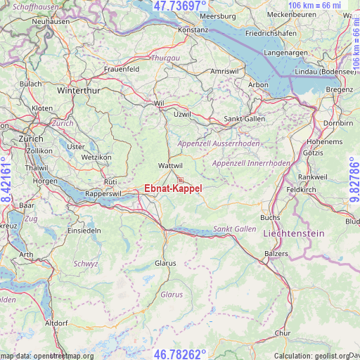
Ebnat-Kappel GPS coordinates[2]
47° 15' 43.02" North, 9° 7' 29.028" East
| Map corner | latitude | longitude |
|---|---|---|
| Upper-left | 47.73697°, | 8.42161° |
| Center: | 47.26195°, | 9.12473° |
| Lower-right: | 46.78262°, | 9.82786° |
| Map W x H: | 106.1×106.1 km | = 65.9×65.9mi |
| max Lat: | 47.76737° ⇑46.8% North |
| Ebnat-Kappel: | 47.26195° |
| min Lat: | ⇓53.2% South 45.83203° |
| min Long | Ebnat-Kappel | max Long |
| 5.97153° | 9.12473° | 10.44624° |
| W 91.5%⇐ | ⇒8.5% E |
Elevation
Elevation of Ebnat-Kappel is 644 m = 2113 ft, and this is 85.8 m = 281 ft above average elevation for this country.
| Max E: |
1845 m = 6053 ft | 21.7% |
| Ebnat-Kappel | 644 m 2113 ft | |
| Avg. | 558.2 m = 1831 ft | |
Min E: |
197 m = 646 ft | 78.3% |
See also: Switzerland elevation on elevation.city.
Geographical zone
Ebnat-Kappel is located in North temperate zone (between Tropic of Cancer and the Arctic Circle). Distance of this North polar circle is 2146.1 km =1333.5 mi to North.| Distance of | km | miles | from Ebnat-Kappel |
|---|---|---|---|
| North Pole | 4752 | 2952.8 | to North |
| Arctic Circle | 2146.1 | 1333.5 | to North |
| Tropic Cancer | 2649.1 | 1646.1 | to South |
| Equator | 5255 | 3265.3 | to South |


Nearby cities:
15 places around Ebnat-Kappel: (largest is in red/bold)
• Benken
11.3 km =7 mi,  231°
231°
• Brunnadern
8.2 km =5.1 mi,  2°
2°
• Bütschwil
11.6 km =7.2 mi,  340°
340°
• Goldingen
12.3 km =7.6 mi,  271°
271°
• Gommiswald
8.4 km =5.2 mi,  245°
245°
• Hemberg
5.7 km =3.5 mi,  41°
41°
• Kaltbrunn
9.2 km =5.7 mi, 234°
• Krummenau
3.8 km =2.4 mi,  114°
114°
• Lichtensteig
7.4 km =4.6 mi, 337°
• Mogelsberg
11.2 km =7 mi, 4°
• Oberhelfenschwil
10.6 km =6.6 mi,  354°
354°
• Sankt Gallenkappel
12.3 km =7.6 mi,  260°
260°
• Sankt Peterzell
7.3 km =4.5 mi,  31°
31°
• Uznach
11.5 km =7.1 mi, 248°
• Wattwil
5.1 km =3.2 mi,  325°
325°
Sources, notices
• [Note1] Compared only with cities in Switzerland existing in our database
• [Src1] Map data: © OpenStreetMap contributors (CC-BY-SA)
• [Src2] Other city data from geonames.org with taken over terms of usage.
• [Src3] Geographical zone / Annual Mean Temperature by Robert A. Rohde @ Wikipedia
