Le Locle geodata
Le Locle (Neuchâtel) is a seat of a second-order administrative division; located in Switzerland in Europe/Zurich (GMT+2) time zone. With population of 10,279 people, there are 141 cities with bigger population in this country. Compared to other cities in Switzerland, 61.4% of cities are located further ↑North; 92.1% of cities are located further →East and 93.5% of cities have lower elevation than Le Locle. Note1


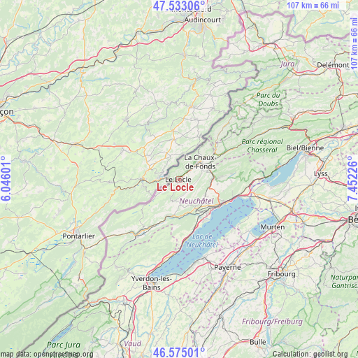
Le Locle GPS coordinates[2]
47° 3' 22.284" North, 6° 44' 56.868" East
| Map corner | latitude | longitude |
|---|---|---|
| Upper-left | 47.53306°, | 6.04601° |
| Center: | 47.05619°, | 6.74913° |
| Lower-right: | 46.57501°, | 7.45226° |
| Map W x H: | 106.5×106.5 km | = 66.2×66.2mi |
| max Lat: | 47.76737° ⇑61.4% North |
| Le Locle: | 47.05619° |
| min Lat: | ⇓38.6% South 45.83203° |
| min Long | Le Locle | max Long |
| 5.97153° | 6.74913° | 10.44624° |
| W 7.9%⇐ | ⇒92.1% E |
Elevation
Elevation of Le Locle is 934 m = 3064 ft, and this is 375.8 m = 1233 ft above average elevation for this country.
| Max E: |
1845 m = 6053 ft | 6.5% |
| Le Locle | 934 m 3064 ft | |
| Avg. | 558.2 m = 1831 ft | |
Min E: |
197 m = 646 ft | 93.5% |
See also: Switzerland elevation on elevation.city.
Geographical zone
Le Locle is located in North temperate zone (between Tropic of Cancer and the Arctic Circle). Distance of this North polar circle is 2169 km =1347.8 mi to North.| Distance of | km | miles | from Le Locle |
|---|---|---|---|
| North Pole | 4774.9 | 2967 | to North |
| Arctic Circle | 2169 | 1347.8 | to North |
| Tropic Cancer | 2626.2 | 1631.8 | to South |
| Equator | 5232.2 | 3251.1 | to South |


Nearby cities:
15 places around Le Locle: (largest is in red/bold)
• Auvernier
13.3 km =8.3 mi,  132°
132°
• Boudevilliers
11.1 km =6.9 mi,  106°
106°
• Boudry
13.6 km =8.5 mi,  150°
150°
• Cernier
11.5 km =7.1 mi,  88°
88°
• Chézard-Saint-Martin
14 km =8.7 mi, 85°
• Fontainemelon
10.4 km =6.5 mi, 90°
• La Brévine
13.7 km =8.5 mi,  232°
232°
• La Chaux-de-Fonds
7.6 km =4.7 mi,  50°
50°
• La Sagne
4.7 km =2.9 mi,  104°
104°
• Les Brenets
3.6 km =2.2 mi,  290°
290°
• Les Geneveys-sur-Coffrane
9 km =5.6 mi,  120°
120°
• Les Ponts-de-Martel
6.7 km =4.2 mi,  192°
192°
• Noiraigue
11.3 km =7 mi, 189°
• Peseux
13.1 km =8.1 mi, 125°
• Rochefort
9.8 km =6.1 mi, 152°
Sources, notices
• [Note1] Compared only with cities in Switzerland existing in our database
• [Src1] Map data: © OpenStreetMap contributors (CC-BY-SA)
• [Src2] Other city data from geonames.org with taken over terms of usage.
• [Src3] Geographical zone / Annual Mean Temperature by Robert A. Rohde @ Wikipedia
