Les Ponts-de-Martel geodata
Les Ponts-de-Martel (Neuchâtel) is a populated place; located in Switzerland in Europe/Zurich (GMT+2) time zone. With population of 1,278 people, there are 1147 cities with bigger population in this country. Compared to other cities in Switzerland, 64.6% of cities are located further ↑North; 92.3% of cities are located further →East and 95% of cities have lower elevation than Les Ponts-de-Martel. Note1
Administrative division(s):
- Level 1: Neuchâtel
- Level 2: Le Locle District
- Level 3: Les Ponts-de-Martel


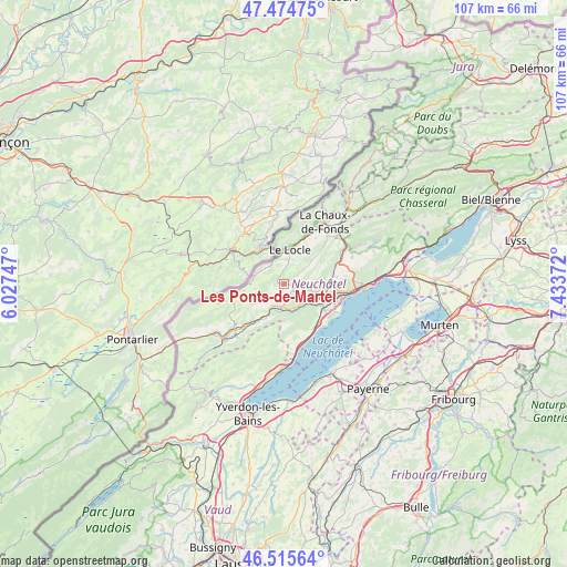
Les Ponts-de-Martel GPS coordinates[2]
46° 59' 50.46" North, 6° 43' 50.124" East
| Map corner | latitude | longitude |
|---|---|---|
| Upper-left | 47.47475°, | 6.02747° |
| Center: | 46.99735°, | 6.73059° |
| Lower-right: | 46.51564°, | 7.43372° |
| Map W x H: | 106.6×106.6 km | = 66.2×66.2mi |
| max Lat: | 47.76737° ⇑64.6% North |
| Les Ponts-de-Martel: | 46.99735° |
| min Lat: | ⇓35.4% South 45.83203° |
| min Long | Les Ponts-de-Ma | max Long |
| 5.97153° | 6.73059° | 10.44624° |
| W 7.7%⇐ | ⇒92.3% E |
Elevation
Elevation of Les Ponts-de-Martel is 1007 m = 3304 ft, and this is 448.8 m = 1472 ft above average elevation for this country.
| Max E: |
1845 m = 6053 ft | 5% |
| Les Ponts-de-Martel | 1007 m 3304 ft | |
| Avg. | 558.2 m = 1831 ft | |
Min E: |
197 m = 646 ft | 95% |
See also: Switzerland elevation on elevation.city.
Geographical zone
Les Ponts-de-Martel is located in North temperate zone (between Tropic of Cancer and the Arctic Circle). Distance of this North polar circle is 2175.6 km =1351.9 mi to North.| Distance of | km | miles | from Les Ponts-de-Martel |
|---|---|---|---|
| North Pole | 4781.4 | 2971 | to North |
| Arctic Circle | 2175.6 | 1351.9 | to North |
| Tropic Cancer | 2619.7 | 1627.8 | to South |
| Equator | 5225.6 | 3247 | to South |


Nearby cities:
15 places around Les Ponts-de-Martel: (largest is in red/bold)
• Auvernier
11.5 km =7.1 mi,  102°
102°
• Bevaix
9.9 km =6.2 mi,  139°
139°
• Boudry
9.7 km =6 mi,  123°
123°
• Cortaillod
10.5 km =6.5 mi, 124°
• Couvet
10.9 km =6.8 mi,  222°
222°
• Gorgier
11.3 km =7 mi,  160°
160°
• La Brévine
9.6 km =6 mi,  258°
258°
• La Sagne
8.1 km =5 mi,  47°
47°
• Le Locle
6.7 km =4.2 mi,  12°
12°
• Les Brenets
8.1 km =5 mi,  345°
345°
• Les Geneveys-sur-Coffrane
9.4 km =5.8 mi,  77°
77°
• Noiraigue
4.6 km =2.9 mi,  185°
185°
• Rochefort
6.3 km =3.9 mi,  110°
110°
• Saint-Aubin-Sauges
11.9 km =7.4 mi, 164°
• Travers
7.6 km =4.7 mi,  213°
213°
Sources, notices
• [Note1] Compared only with cities in Switzerland existing in our database
• [Src1] Map data: © OpenStreetMap contributors (CC-BY-SA)
• [Src2] Other city data from geonames.org with taken over terms of usage.
• [Src3] Geographical zone / Annual Mean Temperature by Robert A. Rohde @ Wikipedia
