Langenthal geodata
Langenthal (Bern) is a populated place; located in Switzerland in Europe/Zurich (GMT+2) time zone. With population of 14,184 people, there are 89 cities with bigger population in this country. Compared to other cities in Switzerland, 51.2% of cities are located further ↑North; 65.6% of cities are located further →East and 50.2% of cities have lower elevation than Langenthal. Note1


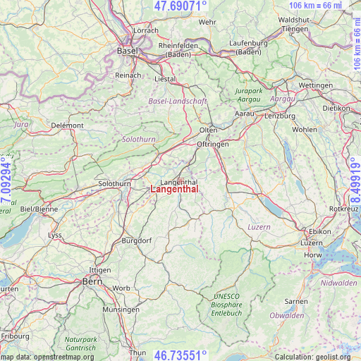
Langenthal GPS coordinates[2]
47° 12' 54.936" North, 7° 47' 45.852" East
| Map corner | latitude | longitude |
|---|---|---|
| Upper-left | 47.69071°, | 7.09294° |
| Center: | 47.21526°, | 7.79607° |
| Lower-right: | 46.73551°, | 8.49919° |
| Map W x H: | 106.2×106.2 km | = 66×66mi |
| max Lat: | 47.76737° ⇑51.2% North |
| Langenthal: | 47.21526° |
| min Lat: | ⇓48.8% South 45.83203° |
| min Long | Langenthal | max Long |
| 5.97153° | 7.79607° | 10.44624° |
| W 34.4%⇐ | ⇒65.6% E |
Elevation
Elevation of Langenthal is 478 m = 1568 ft, and this is 80.2 m = 263 ft below average elevation for this country.
| Max E: |
1845 m = 6053 ft | 49.8% |
| Avg. | 558.2 m = 1831 ft | |
| Langenthal | 478 m = 1568 ft | |
Min E: |
197 m = 646 ft | 50.2% |
See also: Switzerland elevation on elevation.city.
Geographical zone
Langenthal is located in North temperate zone (between Tropic of Cancer and the Arctic Circle). Distance of this North polar circle is 2151.3 km =1336.8 mi to North.| Distance of | km | miles | from Langenthal |
|---|---|---|---|
| North Pole | 4757.2 | 2956 | to North |
| Arctic Circle | 2151.3 | 1336.8 | to North |
| Tropic Cancer | 2643.9 | 1642.8 | to South |
| Equator | 5249.8 | 3262.1 | to South |


Nearby cities:
15 places around Langenthal: (largest is in red/bold)
• Aarwangen
3.3 km =2.1 mi,  321°
321°
• Bannwil
5.3 km =3.3 mi,  301°
301°
• Busswil bei Melchnau
4.2 km =2.6 mi,  140°
140°
• Fulenbach
6.7 km =4.2 mi,  23°
23°
• Herzogenbuchsee
7.4 km =4.6 mi,  245°
245°
• Kleindietwil
7.7 km =4.8 mi,  183°
183°
• Lotzwil
2.7 km =1.7 mi,  188°
188°
• Madiswil
5.6 km =3.5 mi, 178°
• Melchnau
5.6 km =3.5 mi,  131°
131°
• Murgenthal
7.1 km =4.4 mi,  27°
27°
• Pfaffnau
7.8 km =4.8 mi,  79°
79°
• Roggwil
3.5 km =2.2 mi, 33°
• Walliswil bei Niederbipp
8.3 km =5.2 mi,  286°
286°
• Wolfwil
5.9 km =3.7 mi,  0°
0°
• Wynau
4.7 km =2.9 mi, 18°
Sources, notices
• [Note1] Compared only with cities in Switzerland existing in our database
• [Src1] Map data: © OpenStreetMap contributors (CC-BY-SA)
• [Src2] Other city data from geonames.org with taken over terms of usage.
• [Src3] Geographical zone / Annual Mean Temperature by Robert A. Rohde @ Wikipedia
