Herzogenbuchsee geodata
Herzogenbuchsee (Bern) is a populated place; located in Switzerland in Europe/Zurich (GMT+2) time zone. With population of 5,522 people, there are 303 cities with bigger population in this country. Compared to other cities in Switzerland, 53.7% of cities are located further ↑North; 68.2% of cities are located further →East and 52% of cities have higher elevation than Herzogenbuchsee. Note1


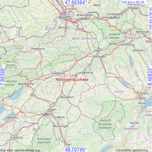
Herzogenbuchsee GPS coordinates[2]
47° 11' 16.62" North, 7° 42' 22.32" East
| Map corner | latitude | longitude |
|---|---|---|
| Upper-left | 47.66364°, | 7.00308° |
| Center: | 47.18795°, | 7.7062° |
| Lower-right: | 46.70796°, | 8.40933° |
| Map W x H: | 106.3×106.3 km | = 66.1×66.1mi |
| max Lat: | 47.76737° ⇑53.7% North |
| Herzogenbuchsee: | 47.18795° |
| min Lat: | ⇓46.3% South 45.83203° |
| min Long | Herzogenbuchsee | max Long |
| 5.97153° | 7.7062° | 10.44624° |
| W 31.8%⇐ | ⇒68.2% E |
Elevation
Elevation of Herzogenbuchsee is 474 m = 1555 ft, and this is 84.2 m = 276 ft below average elevation for this country.
| Max E: |
1845 m = 6053 ft | 52% |
| Avg. | 558.2 m = 1831 ft | |
| Herzogenbuchsee | 474 m = 1555 ft | |
Min E: |
197 m = 646 ft | 48% |
See also: Switzerland elevation on elevation.city.
Geographical zone
Herzogenbuchsee is located in North temperate zone (between Tropic of Cancer and the Arctic Circle). Distance of this North polar circle is 2154.4 km =1338.7 mi to North.| Distance of | km | miles | from Herzogenbuchsee |
|---|---|---|---|
| North Pole | 4760.3 | 2957.9 | to North |
| Arctic Circle | 2154.4 | 1338.7 | to North |
| Tropic Cancer | 2640.9 | 1641 | to South |
| Equator | 5246.8 | 3260.2 | to South |


Nearby cities:
15 places around Herzogenbuchsee: (largest is in red/bold)
• Aarwangen
7.3 km =4.5 mi,  39°
39°
• Bannwil
6.2 km =3.9 mi,  21°
21°
• Deitingen
7.3 km =4.5 mi,  294°
294°
• Kleindietwil
7.9 km =4.9 mi,  126°
126°
• Kriegstetten
8.3 km =5.2 mi,  259°
259°
• Langenthal
7.4 km =4.6 mi,  65°
65°
• Lotzwil
6.4 km =4 mi,  86°
86°
• Madiswil
7.4 km =4.6 mi,  110°
110°
• Oberönz
1.4 km =0.9 mi,  217°
217°
• Ochlenberg
4.8 km =3 mi,  152°
152°
• Seeberg
4.7 km =2.9 mi, 220°
• Subingen
6.7 km =4.2 mi,  280°
280°
• Ursenbach
7.5 km =4.7 mi,  138°
138°
• Walliswil bei Niederbipp
5.5 km =3.4 mi,  347°
347°
• Wangen an der Aare
6.4 km =4 mi,  320°
320°
Sources, notices
• [Note1] Compared only with cities in Switzerland existing in our database
• [Src1] Map data: © OpenStreetMap contributors (CC-BY-SA)
• [Src2] Other city data from geonames.org with taken over terms of usage.
• [Src3] Geographical zone / Annual Mean Temperature by Robert A. Rohde @ Wikipedia
