Ermatingen geodata
Ermatingen (Thurgau) is a populated place; located in Switzerland in Europe/Zurich (GMT+2) time zone. With population of 2,453 people, there are 705 cities with bigger population in this country. Compared to other cities in Switzerland, 98.9% of cities are located further ↓South; 90.6% of cities are located further ←West and 88.4% of cities have higher elevation than Ermatingen. Note1


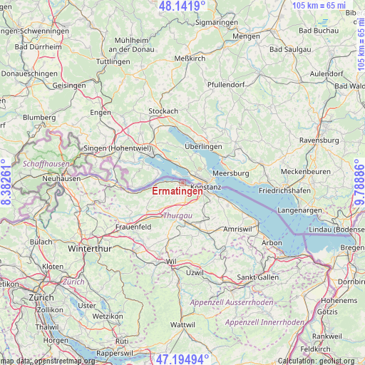
Ermatingen GPS coordinates[2]
47° 40' 14.052" North, 9° 5' 8.628" East
| Map corner | latitude | longitude |
|---|---|---|
| Upper-left | 48.1419°, | 8.38261° |
| Center: | 47.67057°, | 9.08573° |
| Lower-right: | 47.19494°, | 9.78886° |
| Map W x H: | 105.3×105.3 km | = 65.4×65.4mi |
| max Lat: | 47.76737° ⇑1.1% North |
| Ermatingen: | 47.67057° |
| min Lat: | ⇓98.9% South 45.83203° |
| min Long | Ermatingen | max Long |
| 5.97153° | 9.08573° | 10.44624° |
| W 90.6%⇐ | ⇒9.4% E |
Elevation
Elevation of Ermatingen is 401 m = 1316 ft, and this is 157.2 m = 516 ft below average elevation for this country.
| Max E: |
1845 m = 6053 ft | 88.4% |
| Avg. | 558.2 m = 1831 ft | |
| Ermatingen | 401 m = 1316 ft | |
Min E: |
197 m = 646 ft | 11.6% |
See also: Switzerland elevation on elevation.city.
Geographical zone
Ermatingen is located in North temperate zone (between Tropic of Cancer and the Arctic Circle). Distance of this North polar circle is 2100.7 km =1305.3 mi to North.| Distance of | km | miles | from Ermatingen |
|---|---|---|---|
| North Pole | 4706.6 | 2924.5 | to North |
| Arctic Circle | 2100.7 | 1305.3 | to North |
| Tropic Cancer | 2694.6 | 1674.3 | to South |
| Equator | 5300.5 | 3293.6 | to South |


Nearby cities:
15 places around Ermatingen: (largest is in red/bold)
• Berg
11.9 km =7.4 mi,  149°
149°
• Bottighofen
10 km =6.2 mi,  112°
112°
• Gottlieben
3.7 km =2.3 mi,  101°
101°
• Homburg
7.1 km =4.4 mi,  235°
235°
• Hüttlingen
12.9 km =8 mi,  217°
217°
• Kreuzlingen
7.1 km =4.4 mi, 108°
• Märstetten-Dorf
8.8 km =5.5 mi,  188°
188°
• Müllheim
9.8 km =6.1 mi, 218°
• Münsterlingen
11.8 km =7.3 mi, 111°
• Pfyn
12.8 km =8 mi,  230°
230°
• Steckborn
7.7 km =4.8 mi,  266°
266°
• Tägerwilen
4.3 km =2.7 mi, 110°
• Weinfelden
11.6 km =7.2 mi,  174°
174°
• Wigoltingen
9.1 km =5.7 mi,  206°
206°
• Wäldi
4.1 km =2.5 mi, 170°
Sources, notices
• [Note1] Compared only with cities in Switzerland existing in our database
• [Src1] Map data: © OpenStreetMap contributors (CC-BY-SA)
• [Src2] Other city data from geonames.org with taken over terms of usage.
• [Src3] Geographical zone / Annual Mean Temperature by Robert A. Rohde @ Wikipedia
