Gottlieben geodata
Gottlieben (Thurgau) is a seat of a third-order administrative division; located in Switzerland in Europe/Zurich (GMT+2) time zone. With population of 290 people, there are 1814 cities with bigger population in this country. Compared to other cities in Switzerland, 98.6% of cities are located further ↓South; 91.7% of cities are located further ←West and 88.7% of cities have higher elevation than Gottlieben. Note1


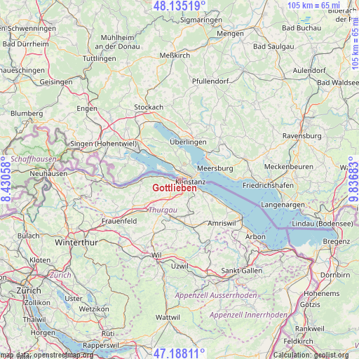
Gottlieben GPS coordinates[2]
47° 39' 49.68" North, 9° 8' 1.356" East
| Map corner | latitude | longitude |
|---|---|---|
| Upper-left | 48.13519°, | 8.43058° |
| Center: | 47.6638°, | 9.13371° |
| Lower-right: | 47.18811°, | 9.83683° |
| Map W x H: | 105.3×105.3 km | = 65.4×65.4mi |
| max Lat: | 47.76737° ⇑1.4% North |
| Gottlieben: | 47.6638° |
| min Lat: | ⇓98.6% South 45.83203° |
| min Long | Gottlieben | max Long |
| 5.97153° | 9.13371° | 10.44624° |
| W 91.7%⇐ | ⇒8.3% E |
Elevation
Elevation of Gottlieben is 400 m = 1312 ft, and this is 158.2 m = 519 ft below average elevation for this country.
| Max E: |
1845 m = 6053 ft | 88.7% |
| Avg. | 558.2 m = 1831 ft | |
| Gottlieben | 400 m = 1312 ft | |
Min E: |
197 m = 646 ft | 11.3% |
See also: Switzerland elevation on elevation.city.
Geographical zone
Gottlieben is located in North temperate zone (between Tropic of Cancer and the Arctic Circle). Distance of this North polar circle is 2101.5 km =1305.8 mi to North.| Distance of | km | miles | from Gottlieben |
|---|---|---|---|
| North Pole | 4707.3 | 2925 | to North |
| Arctic Circle | 2101.5 | 1305.8 | to North |
| Tropic Cancer | 2693.8 | 1673.8 | to South |
| Equator | 5299.7 | 3293.1 | to South |


Nearby cities:
15 places around Gottlieben: (largest is in red/bold)
• Altnau
11.3 km =7 mi,  121°
121°
• Berg
9.8 km =6.1 mi,  165°
165°
• Bottighofen
6.4 km =4 mi, 118°
• Ermatingen
3.7 km =2.3 mi,  281°
281°
• Homburg
10 km =6.2 mi,  251°
251°
• Kreuzlingen
3.4 km =2.1 mi, 115°
• Langrickenbach
11.6 km =7.2 mi,  132°
132°
• Märstetten-Dorf
9.3 km =5.8 mi,  211°
211°
• Müllheim
11.9 km =7.4 mi,  234°
234°
• Münsterlingen
8.2 km =5.1 mi, 115°
• Steckborn
11.3 km =7 mi,  271°
271°
• Tägerwilen
0.9 km =0.6 mi,  148°
148°
• Weinfelden
11.1 km =6.9 mi,  193°
193°
• Wigoltingen
10.6 km =6.6 mi, 226°
• Wäldi
4.4 km =2.7 mi,  221°
221°
Sources, notices
• [Note1] Compared only with cities in Switzerland existing in our database
• [Src1] Map data: © OpenStreetMap contributors (CC-BY-SA)
• [Src2] Other city data from geonames.org with taken over terms of usage.
• [Src3] Geographical zone / Annual Mean Temperature by Robert A. Rohde @ Wikipedia
