Derendingen geodata
Derendingen (Solothurn) is a populated place; located in Switzerland in Europe/Zurich (GMT+2) time zone. With population of 6,093 people, there are 272 cities with bigger population in this country. Compared to other cities in Switzerland, 52.9% of cities are located further ↑North; 72.1% of cities are located further →East and 70.2% of cities have higher elevation than Derendingen. Note1


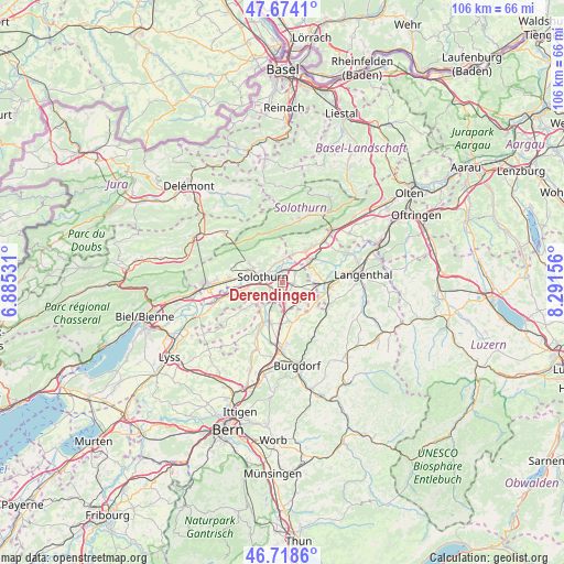
Derendingen GPS coordinates[2]
47° 11' 54.6" North, 7° 35' 18.384" East
| Map corner | latitude | longitude |
|---|---|---|
| Upper-left | 47.6741°, | 6.88531° |
| Center: | 47.1985°, | 7.58844° |
| Lower-right: | 46.7186°, | 8.29156° |
| Map W x H: | 106.2×106.2 km | = 66×66mi |
| max Lat: | 47.76737° ⇑52.9% North |
| Derendingen: | 47.1985° |
| min Lat: | ⇓47.1% South 45.83203° |
| min Long | Derendingen | max Long |
| 5.97153° | 7.58844° | 10.44624° |
| W 27.9%⇐ | ⇒72.1% E |
Elevation
Elevation of Derendingen is 439 m = 1440 ft, and this is 119.2 m = 391 ft below average elevation for this country.
| Max E: |
1845 m = 6053 ft | 70.2% |
| Avg. | 558.2 m = 1831 ft | |
| Derendingen | 439 m = 1440 ft | |
Min E: |
197 m = 646 ft | 29.8% |
See also: Switzerland elevation on elevation.city.
Geographical zone
Derendingen is located in North temperate zone (between Tropic of Cancer and the Arctic Circle). Distance of this North polar circle is 2153.2 km =1337.9 mi to North.| Distance of | km | miles | from Derendingen |
|---|---|---|---|
| North Pole | 4759.1 | 2957.2 | to North |
| Arctic Circle | 2153.2 | 1337.9 | to North |
| Tropic Cancer | 2642.1 | 1641.7 | to South |
| Equator | 5248 | 3261 | to South |


Nearby cities:
15 places around Derendingen: (largest is in red/bold)
• Attiswil
5.7 km =3.5 mi,  19°
19°
• Biberist
2.8 km =1.7 mi,  223°
223°
• Deitingen
2.9 km =1.8 mi,  51°
51°
• Gerlafingen
3.3 km =2.1 mi,  201°
201°
• Koppigen
7.6 km =4.7 mi,  170°
170°
• Kriegstetten
2.8 km =1.7 mi,  164°
164°
• Langendorf
6.1 km =3.8 mi,  292°
292°
• Luterbach
1.8 km =1.1 mi,  350°
350°
• Riedholz
4 km =2.5 mi,  337°
337°
• Seeberg
7.5 km =4.7 mi,  129°
129°
• Solothurn
4 km =2.5 mi, 285°
• Subingen
2.3 km =1.4 mi,  89°
89°
• Wangen an der Aare
6.1 km =3.8 mi, 52°
• Wiedlisbach
7.4 km =4.6 mi,  36°
36°
• Zuchwil
1.7 km =1.1 mi,  282°
282°
Sources, notices
• [Note1] Compared only with cities in Switzerland existing in our database
• [Src1] Map data: © OpenStreetMap contributors (CC-BY-SA)
• [Src2] Other city data from geonames.org with taken over terms of usage.
• [Src3] Geographical zone / Annual Mean Temperature by Robert A. Rohde @ Wikipedia
