Katiola geodata
Katiola (Vallée du Bandama) is a seat of a second-order administrative division; located in Ivory Coast in Africa/Abidjan (GMT+0) time zone. With population of 59,641 people, there are 20 cities with bigger population in this country. Compared to other cities in Ivory Coast, 76.9% of cities are located further ↓South; 57.3% of cities are located further ←West and 72.6% of cities have lower elevation than Katiola. Note1
Administrative division(s):
- Level 1: Vallée du Bandama
- Level 2: Hambol
- Level 3: Département de Katiola


Katiola GPS coordinates[2]
8° 8' 14.208" North, 5° 6' 3.42" West
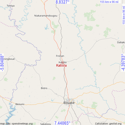
| Map corner | latitude | longitude |
|---|---|---|
| Upper-left | 8.8327°, | -5.80408° |
| Center: | 8.13728°, | -5.10095° |
| Lower-right: | 7.44065°, | -4.39783° |
| Map W x H: | 154.8×154.8 km | = 96.2×96.2mi |
| max Lat: | 10.48115° ⇑23.1% North |
| Katiola: | 8.13728° |
| min Lat: | ⇓76.9% South 4.42295° |
| min Long | Katiola | max Long |
| -8.42592° | -5.10095° | -2.80003° |
| W 57.3%⇐ | ⇒42.7% E |
Elevation
Elevation of Katiola is 326 m = 1070 ft, and this is 101.7 m = 334 ft above average elevation for this country.
| Max E: |
556 m = 1824 ft | 27.4% |
| Katiola | 326 m 1070 ft | |
| Avg. | 224.3 m = 736 ft | |
Min E: |
7 m = 23 ft | 72.6% |
See also: Katiola elevation on elevation.city.
Geographical zone
Katiola is located in North Torrid zone (between Equator and Tropic of Cancer). Distance of Equator is 904.8 km =562.2 mi to South.| Distance of | km | miles | from Katiola |
|---|---|---|---|
| North Pole | 9102.3 | 5655.9 | to North |
| Arctic Circle | 6496.4 | 4036.7 | to North |
| Tropic Cancer | 1701.1 | 1057 | to North |
| Equator | 904.8 | 562.2 | to South |


Nearby cities:
15 places around Katiola: (largest is in red/bold)
• Botro
39.2 km =24.4 mi,  216°
216°
• Bouaké
49.9 km =31 mi,  171°
171°
• Béoumi
73.8 km =45.9 mi,  225°
225°
• Dabakala
78.1 km =48.5 mi,  71°
71°
• Didiévi
114.4 km =71.1 mi, 168°
• Dikodougou
127.1 km =79 mi,  324°
324°
• Kong
124.8 km =77.5 mi,  25°
25°
• Kouassi-Kouassikro
100.1 km =62.2 mi,  152°
152°
• Kounahiri
89.5 km =55.6 mi,  244°
244°
• Mankono
120.2 km =74.7 mi,  265°
265°
• M’Bahiakro
112.9 km =70.2 mi,  132°
132°
• Niakaramandougou
61.5 km =38.2 mi,  340°
340°
• Sakassou
78.8 km =49 mi,  195°
195°
• Tiébissou
109.8 km =68.2 mi,  187°
187°
• Zuénoula
130.9 km =81.3 mi, 233°
Sources, notices
• [Note1] Compared only with cities in Ivory Coast existing in our database
• [Src1] Map data: © OpenStreetMap contributors (CC-BY-SA)
• [Src2] Other city data from geonames.org with taken over terms of usage.
• [Src3] Geographical zone / Annual Mean Temperature by Robert A. Rohde @ Wikipedia
