Zuénoula geodata
Zuénoula (Sassandra-Marahoué) is a seat of a third-order administrative division; located in Ivory Coast in Africa/Abidjan (GMT+0) time zone. With population of 34,435 people, there are 41 cities with bigger population in this country. Compared to other cities in Ivory Coast, 62.4% of cities are located further ↓South; 64.1% of cities are located further →East and 56.4% of cities have higher elevation than Zuénoula. Note1


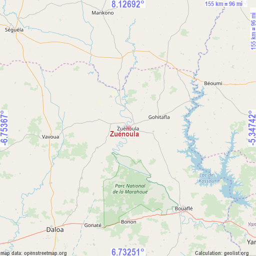
Zuénoula GPS coordinates[2]
7° 25' 48.972" North, 6° 3' 1.944" West
| Map corner | latitude | longitude |
|---|---|---|
| Upper-left | 8.12692°, | -6.75367° |
| Center: | 7.43027°, | -6.05054° |
| Lower-right: | 6.73251°, | -5.34742° |
| Map W x H: | 155×155 km | = 96.3×96.3mi |
| max Lat: | 10.48115° ⇑37.6% North |
| Zuénoula: | 7.43027° |
| min Lat: | ⇓62.4% South 4.42295° |
| min Long | Zuénoula | max Long |
| -8.42592° | -6.05054° | -2.80003° |
| W 35.9%⇐ | ⇒64.1% E |
Elevation
Elevation of Zuénoula is 207 m = 679 ft, and this is 17.3 m = 57 ft below average elevation for this country.
| Max E: |
556 m = 1824 ft | 56.4% |
| Avg. | 224.3 m = 736 ft | |
| Zuénoula | 207 m = 679 ft | |
Min E: |
7 m = 23 ft | 43.6% |
See also: Ivory Coast elevation on elevation.city.
Geographical zone
Zuénoula is located in North Torrid zone (between Equator and Tropic of Cancer). Distance of Equator is 826.2 km =513.4 mi to South.| Distance of | km | miles | from Zuénoula |
|---|---|---|---|
| North Pole | 9180.9 | 5704.7 | to North |
| Arctic Circle | 6575 | 4085.5 | to North |
| Tropic Cancer | 1779.8 | 1105.9 | to North |
| Equator | 826.2 | 513.4 | to South |


Nearby cities:
15 places around Zuénoula: (largest is in red/bold)
• Botro
94.1 km =58.5 mi,  60°
60°
• Bouaflé
59.4 km =36.9 mi,  145°
145°
• Bouaké
116.2 km =72.2 mi,  75°
75°
• Béoumi
58.4 km =36.3 mi, 62°
• Daloa
75.7 km =47 mi,  215°
215°
• Issia
119.9 km =74.5 mi,  209°
209°
• Kounahiri
46.6 km =29 mi,  30°
30°
• Mankono
71.5 km =44.4 mi,  347°
347°
• Sakassou
83.6 km =51.9 mi,  88°
88°
• Sinfra
91.3 km =56.7 mi,  170°
170°
• Séguéla
90.5 km =56.2 mi,  310°
310°
• Tiébissou
96 km =59.7 mi,  108°
108°
• Vavoua
47.4 km =29.5 mi,  263°
263°
• Yamoussoukro
109 km =67.7 mi,  128°
128°
• Zoukougbeu
116.5 km =72.4 mi,  230°
230°
Sources, notices
• [Note1] Compared only with cities in Ivory Coast existing in our database
• [Src1] Map data: © OpenStreetMap contributors (CC-BY-SA)
• [Src2] Other city data from geonames.org with taken over terms of usage.
• [Src3] Geographical zone / Annual Mean Temperature by Robert A. Rohde @ Wikipedia
