Séguéla geodata
Séguéla (Woroba) is a seat of a first-order administrative division; located in Ivory Coast in Africa/Abidjan (GMT+0) time zone. With population of 51,157 people, there are 24 cities with bigger population in this country. Compared to other cities in Ivory Coast, 74.4% of cities are located further ↓South; 76.9% of cities are located further →East and 80.3% of cities have lower elevation than Séguéla. Note1


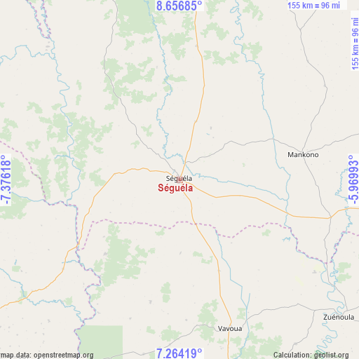
Séguéla GPS coordinates[2]
7° 57' 39.996" North, 6° 40' 23.016" West
| Map corner | latitude | longitude |
|---|---|---|
| Upper-left | 8.65685°, | -7.37618° |
| Center: | 7.96111°, | -6.67306° |
| Lower-right: | 7.26419°, | -5.96993° |
| Map W x H: | 154.8×154.9 km | = 96.2×96.3mi |
| max Lat: | 10.48115° ⇑25.6% North |
| Séguéla: | 7.96111° |
| min Lat: | ⇓74.4% South 4.42295° |
| min Long | Séguéla | max Long |
| -8.42592° | -6.67306° | -2.80003° |
| W 23.1%⇐ | ⇒76.9% E |
Elevation
Elevation of Séguéla is 350 m = 1148 ft, and this is 125.7 m = 412 ft above average elevation for this country.
| Max E: |
556 m = 1824 ft | 19.7% |
| Séguéla | 350 m 1148 ft | |
| Avg. | 224.3 m = 736 ft | |
Min E: |
7 m = 23 ft | 80.3% |
See also: Séguéla elevation on elevation.city.
Geographical zone
Séguéla is located in North Torrid zone (between Equator and Tropic of Cancer). Distance of Equator is 885.2 km =550 mi to South.| Distance of | km | miles | from Séguéla |
|---|---|---|---|
| North Pole | 9121.9 | 5668.1 | to North |
| Arctic Circle | 6516 | 4048.9 | to North |
| Tropic Cancer | 1720.7 | 1069.2 | to North |
| Equator | 885.2 | 550 | to South |


Nearby cities:
15 places around Séguéla: (largest is in red/bold)
• Biankouma
106.5 km =66.2 mi,  256°
256°
• Béoumi
124.5 km =77.4 mi,  104°
104°
• Daloa
123 km =76.4 mi,  168°
168°
• Dianra
118.5 km =73.6 mi,  22°
22°
• Facobly
100.3 km =62.3 mi,  230°
230°
• Kani
58 km =36 mi,  7°
7°
• Koro
109.2 km =67.9 mi,  307°
307°
• Kouibly
99.9 km =62.1 mi,  218°
218°
• Kounahiri
94.2 km =58.5 mi, 101°
• Man
114.6 km =71.2 mi,  237°
237°
• Mankono
54.3 km =33.7 mi,  78°
78°
• Touba
116.8 km =72.6 mi,  287°
287°
• Vavoua
67.9 km =42.2 mi,  161°
161°
• Zoukougbeu
134.9 km =83.8 mi,  188°
188°
• Zuénoula
90.5 km =56.2 mi,  130°
130°
Sources, notices
• [Note1] Compared only with cities in Ivory Coast existing in our database
• [Src1] Map data: © OpenStreetMap contributors (CC-BY-SA)
• [Src2] Other city data from geonames.org with taken over terms of usage.
• [Src3] Geographical zone / Annual Mean Temperature by Robert A. Rohde @ Wikipedia
