Illapel geodata
Illapel (Coquimbo Region) is a seat of a second-order administrative division; located in Chile in America/Santiago (GMT-4) time zone. With population of 22,816 people, there are 73 cities with bigger population in this country. Compared to other cities in Chile, 85.5% of cities are located further ↓South; 66.9% of cities are located further ←West and 75.9% of cities have lower elevation than Illapel. Note1


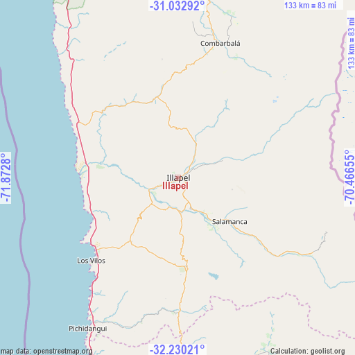
Illapel GPS coordinates[2]
31° 38' 0.564" South, 71° 10' 10.812" West
| Map corner | latitude | longitude |
|---|---|---|
| Upper-left | -31.03292°, | -71.8728° |
| Center: | -31.63349°, | -71.16967° |
| Lower-right: | -32.23021°, | -70.46655° |
| Map W x H: | 133.1×133.1 km | = 82.7×82.7mi |
| max Lat: | -18.19821° ⇑14.5% North |
| Illapel: | -31.63349° |
| min Lat: | ⇓85.5% South -54.93355° |
| min Long | Illapel | max Long |
| -109.42438° | -71.16967° | -67.60963° |
| W 66.9%⇐ | ⇒33.1% E |
Elevation
Elevation of Illapel is 312 m = 1024 ft, and this is 39 m = 128 ft above average elevation for this country.
| Max E: |
3544 m = 11627 ft | 24.1% |
| Illapel | 312 m 1024 ft | |
| Avg. | 273 m = 896 ft | |
Min E: |
1 m = 3 ft | 75.9% |
See also: Chile elevation on elevation.city.
Geographical zone
Illapel is located in South temperate zone (between Tropic of Capricorn and the Antarctic Circle). Distance of this Southern Tropic circle is 911.4 km =566.3 mi to North.| Distance of | km | miles | from Illapel |
|---|---|---|---|
| Equator | 3517.3 | 2185.5 | to North |
| Tropic Capricorn | 911.4 | 566.3 | to North |
| Antarctic Circle | 3883.9 | 2413.3 | to South |
| South Pole | 6489.7 | 4032.5 | to South |


Nearby cities:
15 places around Illapel: (largest is in red/bold)
• Colina
180.7 km =112.3 mi,  165°
165°
• Hacienda La Calera
127.9 km =79.5 mi,  181°
181°
• La Ligua
91.2 km =56.7 mi, 183°
• Limache
154.1 km =95.8 mi, 183°
• Llaillay
135.7 km =84.3 mi, 171°
• Los Andes
143.9 km =89.4 mi,  158°
158°
• Monte Patria
106.3 km =66.1 mi,  10°
10°
• Ovalle
114.8 km =71.3 mi,  358°
358°
• Quillota
139.2 km =86.5 mi, 183°
• Quilpué
159.3 km =99 mi,  189°
189°
• Salamanca
25.3 km =15.7 mi,  129°
129°
• San Felipe
131 km =81.4 mi, 161°
• Valparaíso
161.8 km =100.5 mi,  195°
195°
• Villa Alemana
157.8 km =98.1 mi, 186°
• Viña del Mar
158.8 km =98.7 mi, 193°
Sources, notices
• [Note1] Compared only with cities in Chile existing in our database
• [Src1] Map data: © OpenStreetMap contributors (CC-BY-SA)
• [Src2] Other city data from geonames.org with taken over terms of usage.
• [Src3] Geographical zone / Annual Mean Temperature by Robert A. Rohde @ Wikipedia
