Mundemba geodata
Mundemba (South-West) is a populated place; located in Cameroon in Africa/Douala (GMT+1) time zone. With population of 11,912 people, there are 66 cities with bigger population in this country. Compared to other cities in Cameroon, 50.8% of cities are located further ↑North; 100% of cities are located further →East and 88.5% of cities have higher elevation than Mundemba. Note1


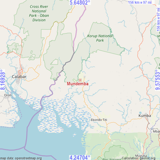
Mundemba GPS coordinates[2]
4° 56' 52.44" North, 8° 52' 20.64" East
| Map corner | latitude | longitude |
|---|---|---|
| Upper-left | 5.64802°, | 8.16928° |
| Center: | 4.9479°, | 8.8724° |
| Lower-right: | 4.24704°, | 9.57553° |
| Map W x H: | 155.8×155.8 km | = 96.8×96.8mi |
| max Lat: | 12.57535° ⇑50.8% North |
| Mundemba: | 4.9479° |
| min Lat: | ⇓49.2% South 2.35° |
| min Long | Mundemba | max Long |
| 8.8724° | 8.8724° | 15.23288° |
| W 0%⇐ | ⇒100% E |
Elevation
Elevation of Mundemba is 111 m = 364 ft, and this is 562.9 m = 1847 ft below average elevation for this country.
| Max E: |
1687 m = 5535 ft | 88.5% |
| Avg. | 673.9 m = 2211 ft | |
| Mundemba | 111 m = 364 ft | |
Min E: |
1 m = 3 ft | 11.5% |
See also: Cameroon elevation on elevation.city.
Geographical zone
Mundemba is located in North Torrid zone (between Equator and Tropic of Cancer). Distance of Equator is 550.2 km =341.9 mi to South.| Distance of | km | miles | from Mundemba |
|---|---|---|---|
| North Pole | 9456.9 | 5876.2 | to North |
| Arctic Circle | 6851 | 4257 | to North |
| Tropic Cancer | 2055.8 | 1277.4 | to North |
| Equator | 550.2 | 341.9 | to South |


Nearby cities:
15 places around Mundemba: (largest is in red/bold)
• Bamusso
54.5 km =33.9 mi,  176°
176°
• Bekondo
57.9 km =36 mi,  120°
120°
• Buea
97.4 km =60.5 mi,  155°
155°
• Kumba
72.5 km =45 mi, 118°
• Limbe
109.2 km =67.9 mi, 160°
• Loum
98.9 km =61.5 mi,  104°
104°
• Mamfe
101.8 km =63.3 mi,  28°
28°
• Manjo
105.8 km =65.7 mi, 96°
• Mbanga
91.6 km =56.9 mi, 122°
• Mutengene
107.1 km =66.5 mi,  152°
152°
• Muyuka
94.4 km =58.7 mi,  140°
140°
• Ndom
91.4 km =56.8 mi, 123°
• Nguti
73.9 km =45.9 mi,  54°
54°
• Penja
95.8 km =59.5 mi,  110°
110°
• Tiko
111.1 km =69 mi, 150°
Sources, notices
• [Note1] Compared only with cities in Cameroon existing in our database
• [Src1] Map data: © OpenStreetMap contributors (CC-BY-SA)
• [Src2] Other city data from geonames.org with taken over terms of usage.
• [Src3] Geographical zone / Annual Mean Temperature by Robert A. Rohde @ Wikipedia
