Manjo geodata
Manjo (Littoral) is a populated place; located in Cameroon in Africa/Douala (GMT+1) time zone. With population of 37,661 people, there are 43 cities with bigger population in this country. Compared to other cities in Cameroon, 52.5% of cities are located further ↑North; 84.4% of cities are located further →East and 59.8% of cities have higher elevation than Manjo. Note1


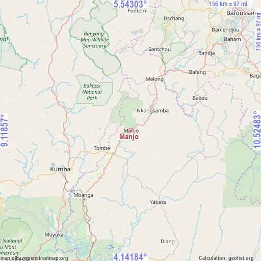
Manjo GPS coordinates[2]
4° 50' 34.08" North, 9° 49' 18.12" East
| Map corner | latitude | longitude |
|---|---|---|
| Upper-left | 5.54303°, | 9.11857° |
| Center: | 4.8428°, | 9.8217° |
| Lower-right: | 4.14184°, | 10.52483° |
| Map W x H: | 155.8×155.8 km | = 96.8×96.8mi |
| max Lat: | 12.57535° ⇑52.5% North |
| Manjo: | 4.8428° |
| min Lat: | ⇓47.5% South 2.35° |
| min Long | Manjo | max Long |
| 8.8724° | 9.8217° | 15.23288° |
| W 15.6%⇐ | ⇒84.4% E |
Elevation
Elevation of Manjo is 526 m = 1726 ft, and this is 147.9 m = 485 ft below average elevation for this country.
| Max E: |
1687 m = 5535 ft | 59.8% |
| Avg. | 673.9 m = 2211 ft | |
| Manjo | 526 m = 1726 ft | |
Min E: |
1 m = 3 ft | 40.2% |
See also: Cameroon elevation on elevation.city.
Geographical zone
Manjo is located in North Torrid zone (between Equator and Tropic of Cancer). Distance of Equator is 538.5 km =334.6 mi to South.| Distance of | km | miles | from Manjo |
|---|---|---|---|
| North Pole | 9468.6 | 5883.5 | to North |
| Arctic Circle | 6862.7 | 4264.3 | to North |
| Tropic Cancer | 2067.5 | 1284.7 | to North |
| Equator | 538.5 | 334.6 | to South |


Nearby cities:
15 places around Manjo: (largest is in red/bold)
• Bafang
52.6 km =32.7 mi,  48°
48°
• Bana
60.6 km =37.7 mi,  56°
56°
• Bekondo
58.3 km =36.2 mi,  252°
252°
• Diang
69.4 km =43.1 mi,  161°
161°
• Dschang
71.6 km =44.5 mi,  20°
20°
• Fontem
69.9 km =43.4 mi,  5°
5°
• Kumba
47.5 km =29.5 mi,  241°
241°
• Loum
16.9 km =10.5 mi,  214°
214°
• Mbanga
47.3 km =29.4 mi,  216°
216°
• Melong
34.7 km =21.6 mi,  26°
26°
• Ndom
47.9 km =29.8 mi, 216°
• Nguti
70.2 km =43.6 mi,  320°
320°
• Nkongsamba
18.1 km =11.2 mi, 46°
• Penja
27.6 km =17.1 mi, 214°
• Yabassi
45.9 km =28.5 mi, 159°
Sources, notices
• [Note1] Compared only with cities in Cameroon existing in our database
• [Src1] Map data: © OpenStreetMap contributors (CC-BY-SA)
• [Src2] Other city data from geonames.org with taken over terms of usage.
• [Src3] Geographical zone / Annual Mean Temperature by Robert A. Rohde @ Wikipedia
