Fulilu geodata
Fulilu (Gansu) is a seat of a third-order administrative division; located in China in Asia/Shanghai (GMT+8) time zone. In our database, there are 1268 cities with bigger population. Compared to other cities in China, 77.4% of cities are located further ↓South; 90.8% of cities are located further →East and 91.9% of cities have lower elevation than Fulilu. Note1


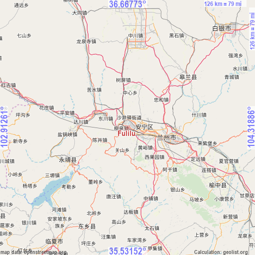
Fulilu GPS coordinates[2]
36° 6' 6.048" North, 103° 36' 56.628" East
| Map corner | latitude | longitude |
|---|---|---|
| Upper-left | 36.66773°, | 102.91261° |
| Center: | 36.10168°, | 103.61573° |
| Lower-right: | 35.53152°, | 104.31886° |
| Map W x H: | 126.3×126.3 km | = 78.5×78.5mi |
| max Lat: | 53.31946° ⇑22.6% North |
| Fulilu: | 36.10168° |
| min Lat: | ⇓77.4% South 18.22056° |
| min Long | Fulilu | max Long |
| 75.07348° | 103.61573° | 134.28917° |
| W 9.2%⇐ | ⇒90.8% E |
Elevation
Elevation of Fulilu is 1565 m = 5135 ft, and this is 1080.2 m = 3544 ft above average elevation for this country.
| Max E: |
5622 m = 18445 ft | 8.1% |
| Fulilu | 1565 m 5135 ft | |
| Avg. | 484.8 m = 1591 ft | |
Min E: |
-3 m = -10 ft | 91.9% |
See also: China elevation on elevation.city.
Geographical zone
Fulilu is located in North temperate zone (between Tropic of Cancer and the Arctic Circle). Distance of this Northern Tropic circle is 1408.2 km =875 mi to South.| Distance of | km | miles | from Fulilu |
|---|---|---|---|
| North Pole | 5992.9 | 3723.8 | to North |
| Arctic Circle | 3387 | 2104.6 | to North |
| Tropic Cancer | 1408.2 | 875 | to South |
| Equator | 4014.1 | 2494.2 | to South |


Nearby cities:
15 places around Fulilu: (largest is in red/bold)
• Anning Xilu
9.3 km =5.8 mi,  88°
88°
• Baiyin
70.1 km =43.6 mi,  45°
45°
• Gaolan Chengguanzhen
39.3 km =24.4 mi, 48°
• Guanghe Chengguanzhen
69 km =42.9 mi,  182°
182°
• Guanjiachuan
72 km =44.7 mi,  238°
238°
• Lanzhou
20.7 km =12.9 mi,  103°
103°
• Linxia Chengguanzhen
66.9 km =41.6 mi,  213°
213°
• Liujiaxia
32.6 km =20.3 mi, 235°
• Renminlu
70.4 km =43.7 mi,  44°
44°
• Suonan
52.2 km =32.4 mi,  202°
202°
• Wangjia
73 km =45.4 mi,  261°
261°
• Xiaoling
60.3 km =37.5 mi,  247°
247°
• Xihu
14.9 km =9.3 mi, 104°
• Yuzhong Chengguanzhen
53.2 km =33.1 mi,  122°
122°
• Zhangyelu
19.2 km =11.9 mi, 104°
Sources, notices
• [Note1] Compared only with cities in China existing in our database
• [Src1] Map data: © OpenStreetMap contributors (CC-BY-SA)
• [Src2] Other city data from geonames.org with taken over terms of usage.
• [Src3] Geographical zone / Annual Mean Temperature by Robert A. Rohde @ Wikipedia
