Youxikou geodata
Youxikou (Fujian) is a seat of a fourth-order administrative division; located in China in Asia/Shanghai (GMT+8) time zone. In our database, there are 1268 cities with bigger population. Compared to other cities in China, 80.8% of cities are located further ↑North; 72.8% of cities are located further ←West and 63.5% of cities have higher elevation than Youxikou. Note1


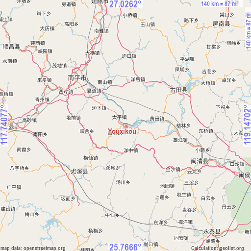
Youxikou GPS coordinates[2]
26° 23' 53.232" North, 118° 26' 38.004" East
| Map corner | latitude | longitude |
|---|---|---|
| Upper-left | 27.0262°, | 117.74077° |
| Center: | 26.39812°, | 118.44389° |
| Lower-right: | 25.7666°, | 119.14702° |
| Map W x H: | 140.1×140.1 km | = 87.1×87.1mi |
| max Lat: | 53.31946° ⇑80.8% North |
| Youxikou: | 26.39812° |
| min Lat: | ⇓19.2% South 18.22056° |
| min Long | Youxikou | max Long |
| 75.07348° | 118.44389° | 134.28917° |
| W 72.8%⇐ | ⇒27.2% E |
Elevation
Elevation of Youxikou is 80 m = 262 ft, and this is 404.8 m = 1328 ft below average elevation for this country.
| Max E: |
5622 m = 18445 ft | 63.5% |
| Avg. | 484.8 m = 1591 ft | |
| Youxikou | 80 m = 262 ft | |
Min E: |
-3 m = -10 ft | 36.5% |
See also: China elevation on elevation.city.
Geographical zone
Youxikou is located in North temperate zone (between Tropic of Cancer and the Arctic Circle). Distance of this Northern Tropic circle is 329.3 km =204.6 mi to South.| Distance of | km | miles | from Youxikou |
|---|---|---|---|
| North Pole | 7071.9 | 4394.3 | to North |
| Arctic Circle | 4466 | 2775 | to North |
| Tropic Cancer | 329.3 | 204.6 | to South |
| Equator | 2935.2 | 1823.8 | to South |


Nearby cities:
15 places around Youxikou: (largest is in red/bold)
• Chimen
16.4 km =10.2 mi,  1°
1°
• Huangtian
18.5 km =11.5 mi,  75°
75°
• Luxia
17.9 km =11.1 mi,  304°
304°
• Meixian
26.2 km =16.3 mi,  228°
228°
• Nanshan
27.4 km =17 mi,  334°
334°
• Shuikou
28.6 km =17.8 mi,  93°
93°
• Tadou
21.5 km =13.4 mi,  262°
262°
• Taiping
5.9 km =3.7 mi, 334°
• Tangchuan
31.6 km =19.6 mi,  183°
183°
• Xiadao
26.2 km =16.3 mi,  318°
318°
• Xibin
7.6 km =4.7 mi,  244°
244°
• Xiongjiang
30.6 km =19 mi,  103°
103°
• Xiwei
24.2 km =15 mi,  196°
196°
• Yanghou
27.7 km =17.2 mi,  13°
13°
• Zhanghuban
4.2 km =2.6 mi,  107°
107°
Sources, notices
• [Note1] Compared only with cities in China existing in our database
• [Src1] Map data: © OpenStreetMap contributors (CC-BY-SA)
• [Src2] Other city data from geonames.org with taken over terms of usage.
• [Src3] Geographical zone / Annual Mean Temperature by Robert A. Rohde @ Wikipedia
