Yongdeng Chengguanzhen geodata
Yongdeng Chengguanzhen (Gansu) is a seat of a third-order administrative division; located in China in Asia/Shanghai (GMT+8) time zone. In our database, there are 1268 cities with bigger population. Compared to other cities in China, 78.6% of cities are located further ↓South; 91.2% of cities are located further →East and 94.9% of cities have lower elevation than Yongdeng Chengguanzhen. Note1
Current local time in Yongdeng Chengguanzhen:
03:21 PM, TuesdayDifference from your time zone: hours


Yongdeng Chengguanzhen GPS coordinates[2]
36° 44' 0.996" North, 103° 15' 33.516" East
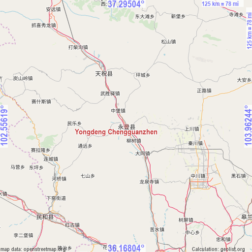
| Map corner | latitude | longitude |
|---|---|---|
| Upper-left | 37.29504°, | 102.55619° |
| Center: | 36.73361°, | 103.25931° |
| Lower-right: | 36.16804°, | 103.96244° |
| Map W x H: | 125.3×125.3 km | = 77.9×77.9mi |
| max Lat: | 53.31946° ⇑21.4% North |
| Yongdeng Chengguanzhen: | 36.73361° |
| min Lat: | ⇓78.6% South 18.22056° |
| min Long | Yongdeng Chengg | max Long |
| 75.07348° | 103.25931° | 134.28917° |
| W 8.8%⇐ | ⇒91.2% E |
Elevation
Elevation of Yongdeng Chengguanzhen is 2103 m = 6900 ft, and this is 1618.2 m = 5309 ft above average elevation for this country.
| Max E: |
5622 m = 18445 ft | 5.1% |
| Yongdeng Chengguanzhen | 2103 m 6900 ft | |
| Avg. | 484.8 m = 1591 ft | |
Min E: |
-3 m = -10 ft | 94.9% |
See also: China elevation on elevation.city.
Geographical zone
Yongdeng Chengguanzhen is located in North temperate zone (between Tropic of Cancer and the Arctic Circle). Distance of this Northern Tropic circle is 1478.5 km =918.7 mi to South.| Distance of | km | miles | from Yongdeng Chengguanzhen |
|---|---|---|---|
| North Pole | 5922.7 | 3680.2 | to North |
| Arctic Circle | 3316.8 | 2061 | to North |
| Tropic Cancer | 1478.5 | 918.7 | to South |
| Equator | 4084.4 | 2537.9 | to South |


Nearby cities:
15 places around Yongdeng Chengguanzhen: (largest is in red/bold)
• Anning Xilu
81.3 km =50.5 mi,  149°
149°
• Baiyin
83.9 km =52.1 mi,  104°
104°
• Fulilu
77.2 km =48 mi,  155°
155°
• Gaolan Chengguanzhen
75.7 km =47 mi,  125°
125°
• Gulang
87.7 km =54.5 mi,  338°
338°
• Haishiwan
56 km =34.8 mi,  219°
219°
• Huazangsi
29.2 km =18.1 mi, 337°
• Lanzhou
91.4 km =56.8 mi, 145°
• Lijiaping
94.6 km =58.8 mi,  207°
207°
• Liujiaxia
89.1 km =55.4 mi,  176°
176°
• Renminlu
83.7 km =52 mi, 104°
• Wangjia
90 km =55.9 mi, 206°
• Xihu
87.4 km =54.3 mi, 148°
• Yitiaoshan
85.2 km =52.9 mi,  56°
56°
• Zhangyelu
90.5 km =56.2 mi, 146°
Sources, notices
• [Note1] Compared only with cities in China existing in our database
• [Src1] Map data: © OpenStreetMap contributors (CC-BY-SA)
• [Src2] Other city data from geonames.org with taken over terms of usage.
• [Src3] Geographical zone / Annual Mean Temperature by Robert A. Rohde @ Wikipedia
