Yitiaoshan geodata
Yitiaoshan (Gansu) is a seat of a third-order administrative division; located in China in Asia/Shanghai (GMT+8) time zone. In our database, there are 1268 cities with bigger population. Compared to other cities in China, 79.5% of cities are located further ↓South; 90.2% of cities are located further →East and 92.3% of cities have lower elevation than Yitiaoshan. Note1


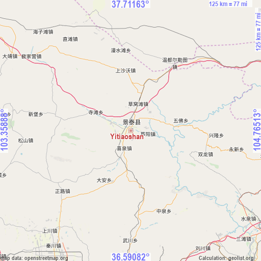
Yitiaoshan GPS coordinates[2]
37° 9' 11.88" North, 104° 3' 43.2" East
| Map corner | latitude | longitude |
|---|---|---|
| Upper-left | 37.71163°, | 103.35888° |
| Center: | 37.1533°, | 104.062° |
| Lower-right: | 36.59082°, | 104.76513° |
| Map W x H: | 124.6×124.6 km | = 77.4×77.4mi |
| max Lat: | 53.31946° ⇑20.5% North |
| Yitiaoshan: | 37.1533° |
| min Lat: | ⇓79.5% South 18.22056° |
| min Long | Yitiaoshan | max Long |
| 75.07348° | 104.062° | 134.28917° |
| W 9.8%⇐ | ⇒90.2% E |
Elevation
Elevation of Yitiaoshan is 1616 m = 5302 ft, and this is 1131.2 m = 3711 ft above average elevation for this country.
| Max E: |
5622 m = 18445 ft | 7.7% |
| Yitiaoshan | 1616 m 5302 ft | |
| Avg. | 484.8 m = 1591 ft | |
Min E: |
-3 m = -10 ft | 92.3% |
See also: China elevation on elevation.city.
Geographical zone
Yitiaoshan is located in North temperate zone (between Tropic of Cancer and the Arctic Circle). Distance of this Northern Tropic circle is 1525.1 km =947.7 mi to South.| Distance of | km | miles | from Yitiaoshan |
|---|---|---|---|
| North Pole | 5876 | 3651.2 | to North |
| Arctic Circle | 3270.1 | 2031.9 | to North |
| Tropic Cancer | 1525.1 | 947.7 | to South |
| Equator | 4131.1 | 2566.9 | to South |


Nearby cities:
15 places around Yitiaoshan: (largest is in red/bold)
• Anning Xilu
120.7 km =75 mi,  194°
194°
• Baiyin
68.1 km =42.3 mi,  171°
171°
• Binhe
106.9 km =66.4 mi,  68°
68°
• Fulilu
123.5 km =76.7 mi,  198°
198°
• Gaolan Chengguanzhen
91.6 km =56.9 mi, 186°
• Gulang
109 km =67.7 mi,  288°
288°
• Huazangsi
84.5 km =52.5 mi,  256°
256°
• Lanzhou
123.5 km =76.7 mi, 189°
• Renminlu
67.6 km =42 mi, 171°
• Wulan
85.6 km =53.2 mi,  139°
139°
• Xihu
123.4 km =76.7 mi, 191°
• Xingpinglu
81.9 km =50.9 mi,  125°
125°
• Yongdeng Chengguanzhen
85.2 km =52.9 mi,  236°
236°
• Zhangyelu
123.7 km =76.9 mi, 189°
• Zhongwei
107.4 km =66.7 mi, 68°
Sources, notices
• [Note1] Compared only with cities in China existing in our database
• [Src1] Map data: © OpenStreetMap contributors (CC-BY-SA)
• [Src2] Other city data from geonames.org with taken over terms of usage.
• [Src3] Geographical zone / Annual Mean Temperature by Robert A. Rohde @ Wikipedia
