Chuanshan geodata
Chuanshan (Guangxi) is a seat of a fourth-order administrative division; located in China in Asia/Shanghai (GMT+8) time zone. In our database, there are 1268 cities with bigger population. Compared to other cities in China, 86.1% of cities are located further ↑North; 80.3% of cities are located further →East and 66.9% of cities have lower elevation than Chuanshan. Note1


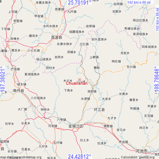
Chuanshan GPS coordinates[2]
25° 4' 0.012" North, 108° 4' 59.988" East
| Map corner | latitude | longitude |
|---|---|---|
| Upper-left | 25.70191°, | 107.38021° |
| Center: | 25.06667°, | 108.08333° |
| Lower-right: | 24.42812°, | 108.78646° |
| Map W x H: | 141.6×141.6 km | = 88×88mi |
| max Lat: | 53.31946° ⇑86.1% North |
| Chuanshan: | 25.06667° |
| min Lat: | ⇓13.9% South 18.22056° |
| min Long | Chuanshan | max Long |
| 75.07348° | 108.08333° | 134.28917° |
| W 19.7%⇐ | ⇒80.3% E |
Elevation
Elevation of Chuanshan is 358 m = 1175 ft, and this is 126.8 m = 416 ft below average elevation for this country.
| Max E: |
5622 m = 18445 ft | 33.1% |
| Avg. | 484.8 m = 1591 ft | |
| Chuanshan | 358 m = 1175 ft | |
Min E: |
-3 m = -10 ft | 66.9% |
See also: China elevation on elevation.city.
Geographical zone
Chuanshan is located in North temperate zone (between Tropic of Cancer and the Arctic Circle). Distance of this Northern Tropic circle is 181.2 km =112.6 mi to South.| Distance of | km | miles | from Chuanshan |
|---|---|---|---|
| North Pole | 7219.9 | 4486.2 | to North |
| Arctic Circle | 4614 | 2867 | to North |
| Tropic Cancer | 181.2 | 112.6 | to South |
| Equator | 2787.2 | 1731.9 | to South |


Nearby cities:
15 places around Chuanshan: (largest is in red/bold)
• Darong
111.9 km =69.5 mi,  44°
44°
• Dingdan
89.6 km =55.7 mi,  11°
11°
• Donglan
91.1 km =56.6 mi,  230°
230°
• Dongmen
87.8 km =54.6 mi,  110°
110°
• Gaowu
99.5 km =61.8 mi,  56°
56°
• Liupai
91.7 km =57 mi,  268°
268°
• Maolan
35.9 km =22.3 mi,  358°
358°
• Nandan Chengguanzhen
53.4 km =33.2 mi,  263°
263°
• Pingjiang
101.2 km =62.9 mi, 35°
• Pingjiang
105.3 km =65.4 mi,  17°
17°
• Shangjiang
97.5 km =60.6 mi,  1°
1°
• Si’en
31.4 km =19.5 mi,  142°
142°
• Tingdong
99.6 km =61.9 mi,  32°
32°
• Xiajiang
98 km =60.9 mi, 38°
• Yaolu
42.9 km =26.7 mi, 356°
Sources, notices
• [Note1] Compared only with cities in China existing in our database
• [Src1] Map data: © OpenStreetMap contributors (CC-BY-SA)
• [Src2] Other city data from geonames.org with taken over terms of usage.
• [Src3] Geographical zone / Annual Mean Temperature by Robert A. Rohde @ Wikipedia
