Nancheng geodata
Nancheng (Shandong) is a seat of a third-order administrative division; located in China in Asia/Shanghai (GMT+8) time zone. In our database, there are 1268 cities with bigger population. Compared to other cities in China, 79% of cities are located further ↓South; 60.1% of cities are located further ←West and 77.2% of cities have higher elevation than Nancheng. Note1


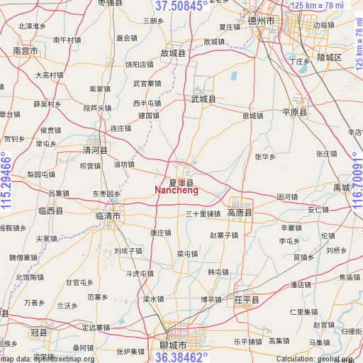
Nancheng GPS coordinates[2]
36° 56' 54.996" North, 115° 59' 52.008" East
| Map corner | latitude | longitude |
|---|---|---|
| Upper-left | 37.50845°, | 115.29466° |
| Center: | 36.94861°, | 115.99778° |
| Lower-right: | 36.38462°, | 116.70091° |
| Map W x H: | 125×125 km | = 77.7×77.7mi |
| max Lat: | 53.31946° ⇑21% North |
| Nancheng: | 36.94861° |
| min Lat: | ⇓79% South 18.22056° |
| min Long | Nancheng | max Long |
| 75.07348° | 115.99778° | 134.28917° |
| W 60.1%⇐ | ⇒39.9% E |
Elevation
Elevation of Nancheng is 32 m = 105 ft, and this is 452.8 m = 1486 ft below average elevation for this country.
| Max E: |
5622 m = 18445 ft | 77.2% |
| Avg. | 484.8 m = 1591 ft | |
| Nancheng | 32 m = 105 ft | |
Min E: |
-3 m = -10 ft | 22.8% |
See also: China elevation on elevation.city.
Geographical zone
Nancheng is located in North temperate zone (between Tropic of Cancer and the Arctic Circle). Distance of this Northern Tropic circle is 1502.4 km =933.5 mi to South.| Distance of | km | miles | from Nancheng |
|---|---|---|---|
| North Pole | 5898.8 | 3665.3 | to North |
| Arctic Circle | 3292.9 | 2046.1 | to North |
| Tropic Cancer | 1502.4 | 933.5 | to South |
| Equator | 4108.3 | 2552.8 | to South |


Nearby cities:
15 places around Nancheng: (largest is in red/bold)
• Dezhou
62.4 km =38.8 mi,  26°
26°
• Dongluqiao
65.6 km =40.8 mi,  243°
243°
• Gaobeijie
29.8 km =18.5 mi,  250°
250°
• Gulou
56.2 km =34.9 mi,  183°
183°
• Jiamaying
29.2 km =18.1 mi,  351°
351°
• Laocheng
23.7 km =14.7 mi,  335°
335°
• Liaocheng
54.8 km =34.1 mi, 181°
• Lingcheng
66.2 km =41.1 mi,  49°
49°
• Liuzhuang
20.8 km =12.9 mi,  287°
287°
• Mingzhou
65.9 km =40.9 mi,  272°
272°
• Qiangezhai
55.1 km =34.2 mi, 271°
• Qingnian
28.1 km =17.5 mi, 244°
• Xiliguantun
15.3 km =9.5 mi, 340°
• Xinhu
61.4 km =38.2 mi, 25°
• Youfang
21.4 km =13.3 mi, 289°
Sources, notices
• [Note1] Compared only with cities in China existing in our database
• [Src1] Map data: © OpenStreetMap contributors (CC-BY-SA)
• [Src2] Other city data from geonames.org with taken over terms of usage.
• [Src3] Geographical zone / Annual Mean Temperature by Robert A. Rohde @ Wikipedia
