Mingzhou geodata
Mingzhou (Hebei) is a seat of a third-order administrative division; located in China in Asia/Shanghai (GMT+8) time zone. In our database, there are 1268 cities with bigger population. Compared to other cities in China, 79.1% of cities are located further ↓South; 55.6% of cities are located further ←West and 74.1% of cities have higher elevation than Mingzhou. Note1


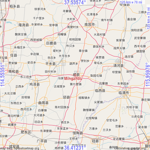
Mingzhou GPS coordinates[2]
36° 58' 33.96" North, 115° 15' 23.868" East
| Map corner | latitude | longitude |
|---|---|---|
| Upper-left | 37.53574°, | 114.55351° |
| Center: | 36.9761°, | 115.25663° |
| Lower-right: | 36.41231°, | 115.95976° |
| Map W x H: | 124.9×124.9 km | = 77.6×77.6mi |
| max Lat: | 53.31946° ⇑20.9% North |
| Mingzhou: | 36.9761° |
| min Lat: | ⇓79.1% South 18.22056° |
| min Long | Mingzhou | max Long |
| 75.07348° | 115.25663° | 134.28917° |
| W 55.6%⇐ | ⇒44.4% E |
Elevation
Elevation of Mingzhou is 39 m = 128 ft, and this is 445.8 m = 1463 ft below average elevation for this country.
| Max E: |
5622 m = 18445 ft | 74.1% |
| Avg. | 484.8 m = 1591 ft | |
| Mingzhou | 39 m = 128 ft | |
Min E: |
-3 m = -10 ft | 25.9% |
See also: China elevation on elevation.city.
Geographical zone
Mingzhou is located in North temperate zone (between Tropic of Cancer and the Arctic Circle). Distance of this Northern Tropic circle is 1505.4 km =935.4 mi to South.| Distance of | km | miles | from Mingzhou |
|---|---|---|---|
| North Pole | 5895.7 | 3663.4 | to North |
| Arctic Circle | 3289.8 | 2044.2 | to North |
| Tropic Cancer | 1505.4 | 935.4 | to South |
| Equator | 4111.4 | 2554.7 | to South |


Nearby cities:
15 places around Mingzhou: (largest is in red/bold)
• Chensan
28.8 km =17.9 mi,  202°
202°
• Dongliang’erzhuang
27.7 km =17.2 mi,  180°
180°
• Dongluqiao
33.6 km =20.9 mi,  167°
167°
• Gaobeijie
40.1 km =24.9 mi,  109°
109°
• Guancheng
57.4 km =35.7 mi,  163°
163°
• Guantao
48.4 km =30.1 mi, 177°
• Laocheng
59 km =36.7 mi,  71°
71°
• Liuzhuang
46.1 km =28.6 mi,  86°
86°
• Nangong
43.7 km =27.2 mi,  13°
13°
• Qiangezhai
10.9 km =6.8 mi,  97°
97°
• Qingnian
43.2 km =26.8 mi, 110°
• Xiliguantun
61.8 km =38.4 mi,  79°
79°
• Xinmatou
19.2 km =11.9 mi, 203°
• Xiying
58.7 km =36.5 mi, 176°
• Youfang
45.7 km =28.4 mi, 85°
Sources, notices
• [Note1] Compared only with cities in China existing in our database
• [Src1] Map data: © OpenStreetMap contributors (CC-BY-SA)
• [Src2] Other city data from geonames.org with taken over terms of usage.
• [Src3] Geographical zone / Annual Mean Temperature by Robert A. Rohde @ Wikipedia
