Gaobeijie geodata
Gaobeijie (Hebei) is a seat of a fourth-order administrative division; located in China in Asia/Shanghai (GMT+8) time zone. In our database, there are 1268 cities with bigger population. Compared to other cities in China, 78.9% of cities are located further ↓South; 58% of cities are located further ←West and 76.2% of cities have higher elevation than Gaobeijie. Note1


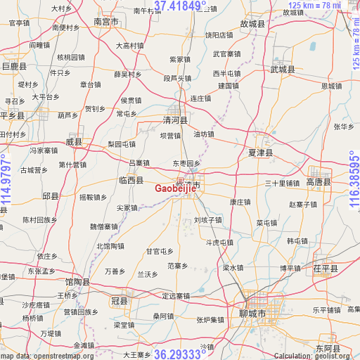
Gaobeijie GPS coordinates[2]
36° 51' 28.728" North, 115° 40' 58.152" East
| Map corner | latitude | longitude |
|---|---|---|
| Upper-left | 37.41849°, | 114.9797° |
| Center: | 36.85798°, | 115.68282° |
| Lower-right: | 36.29333°, | 116.38595° |
| Map W x H: | 125.1×125.1 km | = 77.7×77.7mi |
| max Lat: | 53.31946° ⇑21.1% North |
| Gaobeijie: | 36.85798° |
| min Lat: | ⇓78.9% South 18.22056° |
| min Long | Gaobeijie | max Long |
| 75.07348° | 115.68282° | 134.28917° |
| W 58%⇐ | ⇒42% E |
Elevation
Elevation of Gaobeijie is 34 m = 112 ft, and this is 450.8 m = 1479 ft below average elevation for this country.
| Max E: |
5622 m = 18445 ft | 76.2% |
| Avg. | 484.8 m = 1591 ft | |
| Gaobeijie | 34 m = 112 ft | |
Min E: |
-3 m = -10 ft | 23.8% |
See also: China elevation on elevation.city.
Geographical zone
Gaobeijie is located in North temperate zone (between Tropic of Cancer and the Arctic Circle). Distance of this Northern Tropic circle is 1492.3 km =927.3 mi to South.| Distance of | km | miles | from Gaobeijie |
|---|---|---|---|
| North Pole | 5908.8 | 3671.6 | to North |
| Arctic Circle | 3303 | 2052.4 | to North |
| Tropic Cancer | 1492.3 | 927.3 | to South |
| Equator | 4098.2 | 2546.5 | to South |


Nearby cities:
15 places around Gaobeijie: (largest is in red/bold)
• Chensan
50.7 km =31.5 mi,  254°
254°
• Dongliang’erzhuang
40.7 km =25.3 mi, 249°
• Dongluqiao
36.2 km =22.5 mi,  237°
237°
• Guancheng
47.4 km =29.5 mi,  207°
207°
• Guantao
50.1 km =31.1 mi,  225°
225°
• Jiamaying
45.6 km =28.3 mi,  31°
31°
• Laocheng
36.5 km =22.7 mi, 29°
• Liuzhuang
18.2 km =11.3 mi, 26°
• Mingzhou
40.1 km =24.9 mi,  289°
289°
• Nancheng
29.8 km =18.5 mi,  70°
70°
• Qiangezhai
29.5 km =18.3 mi, 293°
• Qingnian
3.2 km =2 mi,  127°
127°
• Xiliguantun
33.6 km =20.9 mi,  43°
43°
• Xinmatou
45.8 km =28.5 mi,  264°
264°
• Youfang
18.7 km =11.6 mi,  24°
24°
Sources, notices
• [Note1] Compared only with cities in China existing in our database
• [Src1] Map data: © OpenStreetMap contributors (CC-BY-SA)
• [Src2] Other city data from geonames.org with taken over terms of usage.
• [Src3] Geographical zone / Annual Mean Temperature by Robert A. Rohde @ Wikipedia
